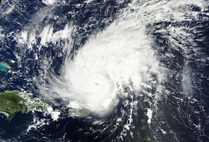
TORONTO – Hurricane Gonzalo is continuing to churn in the Atlantic Ocean and may have its eye set on Atlantic Canada.

The Canadian Hurricane Centre issued its first statement on Gonzalo Tuesday afternoon for Newfoundland and Nova Scotia.
READ MORE: Hurricane Gonzalo strengthens in eastern Caribbean
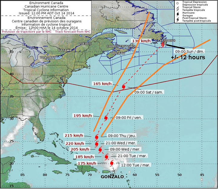
Chris Fogarty, manager of the centre, said that it’s too early to know for certain the track of the hurricane. At the moment, the cone of error places the eye anywhere from east of Cape Breton to the Grand Banks, a 600 kilometre-wide area.
As the storm continues on its track, meteorologists will have a better understanding of the hurricane’s path.
However, the area that will likely see the greatest impact is Newfoundland as high winds are anticipated. Nova Scotia, however, can expect heavy rainfall with the storm.
Gonzalo is a Category 3 hurricane with winds of about 185 km/h. Further strengthening is expected.

Get breaking National news
Nova Scotia may begin to feel the effects of Hurricane Gonzalo early Saturday morning as rain begins. The storm will continue to move northeast before reaching Newfoundland late Saturday into early Sunday.
In the meantime, residents in Nova Scotia and Newfoundland are encouraged to take precautions.
In Nova Scotia, where rain may be quite heavy, people may want to move valuable things that may be on lower levels of their homes to higher levels.
In Newfoundland, residents may want to prepare by withdrawing cash to have on hand in case of a power outage due to strong winds.
Though the storm is expected to once again weaken after strengthening on Wednesday, Fogarty encourages people to keep an eye on the weather.
“It’s a case where we want people to keep their eyes open, their heads up, check the forecast updates, just to see where things are trending,” Fogarty said.
To get real-time weather for your area, download the Global News Skytracker weather app.


Comments