
After several days of frosty weather across much of Alberta and some ski hills reporting record snowfalls so far this winter, a big melt is on the way, with daytime temperatures in many areas expected to spike into the plus-double digits over the weekend and well into next week.

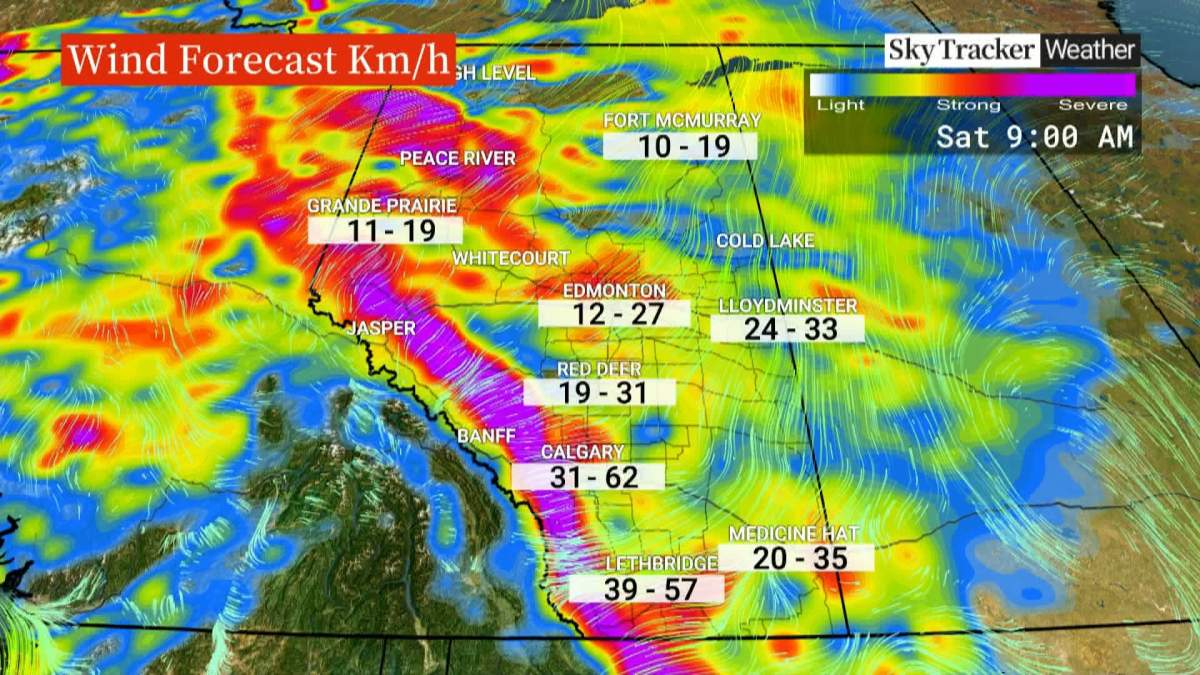
“The warmup will be felt across much of Alberta, but it will be strongest in the south and along the foothills,” said Global Calgary weather specialist Joelle Tomlinson.
“Central Alberta will also see noticeably milder temperatures, while northern parts of the province warm up more modestly.”
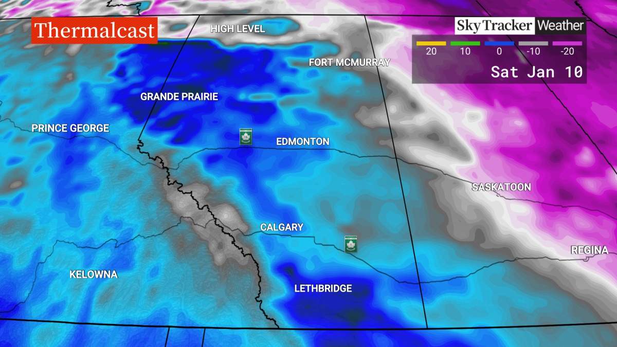
In Calgary, where the normal daytime high at this time of year is about -3 C, Environment Canada is forecasting the mercury to hit near +10 C on Saturday.
In Edmonton, where the normal daytime high is about -8 C, the high on Saturday is forecast near +7 C.

Get breaking National news
“In southern Alberta, cities like Lethbridge could see highs close to +13 C,” said Tomlinson. “Even the mountains are warming, with Banff expected to climb above freezing during the day. Those temperatures are well above normal and will feel more like early spring than mid-winter.”
“There are a couple of factors at play here,” said Tomlinson. “This warmup is being driven by mild Pacific air moving inland, combined with downslope winds off the Rockies and as air descends the eastern slopes of the mountains, it compresses and warms, which creates Chinook-like conditions in southern Alberta.”
“The warmup is also part of a broader warming pattern across western North America, with a ridge of high pressure allowing mild air to surge north while colder arctic air is pushed farther east, with Alberta sitting in an ideal position to feel the effects of that pattern,” Tomlinson added.

And as pleasant as the weekend weather sounds, the temperatures could get even warmer next week when some records could be set.
The forecast high on Wednesday is expected to hit +8 C in Edmonton, +16 C in Calgary, and up to +18 C in Lethbridge.
If that happens it would break the all-time high temperature for Jan. 14 in Calgary, which was set in 2004, when the mercury hit +11.2 C.
It would also be a swing of more that 50 degrees compared to the same day in 1909 when the temperature hit a record low of -36.8 C.


Comments
Want to discuss? Please read our Commenting Policy first.