


Scientists around the world now have access to near-real-time oceanic data from one of the most remote places on Earth — thanks, in part, to the work of a Canadian team.

It’s a joint project by the University of Victoria’s Ocean Networks Canada and the Spanish National Research Council, which maintains a research station in Antarctica.
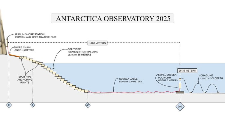
Last year, the group deployed an underwater observatory 23 metres below the ocean’s surface of the coast of Livingston Island, where the Spanish Juan Carlos I Antarctic Station is located, which is capable of streaming data to the internet.

They’ve now installed a more powerful system that can collect more detailed, higher-quality data that’s uploaded and also more quickly uploaded to the web.
Ocean Networks Canada president and CEO Kate Moran said the technology will give researchers a powerful new tool.

Get daily National news
“The interest is really understanding how our ocean is changing as climate change advances,” she said.
Researchers have traditionally focused on the state of Antarctic sheet ice, Moran said.
“But there is another aspect of ice in Antarctica, which is not as well understood, and that’s the surrounding sea ice, that’s the frozen ocean surface, and it has been reducing in extent over the past several years,” she said.
Data from the new observatory and satellite transmitter began flowing to Ocean Networks Canada Oceans 3.0 portal just a few weeks ago.
- 2 tornadoes touched down in Rocky Mountain House, Environment Canada confirms
- How the Northern Tornadoes Project helps verify twisters as Alberta on track for record year
- Calgary area ‘very uniquely situated’ for study of hailstorms, says researcher
- New Asia Highlands exhibit, with some new species, opens at the Calgary Zoo


The package includes a new instrument measuring ocean salinity, temperature and pressure, along with sensors tracking dissolved oxygen concentrations, water turbidity and chlorophyll levels — all elements scientists are keen to observe at the location where freshwater from glacial melt mixes with the ocean.
“Understanding the coastal ocean environment will help us understand is that really a climate signal? Is it changing fast? And what does that mean for the changing environment for marine life for example,” Moran explained.
“It’s also helping Canada raise its status under the Antarctic Treaty, so it’s a two-fer.”
Prior to the station being installed, Antarctic data came primarily from surface satellites, some floating research equipment and people on cruises, according to Moran.
The Antarctic project uses similar technology to tools Ocean Networks Canada has been using to monitor conditions off the B.C. coast for years.
Comments
Want to discuss? Please read our Commenting Policy first.