UPDATE: As of Friday morning, much of Alberta was under a snowfall warning. For a complete list of areas in Alberta under a weather alert, visit the Environment and Climate Change Canada website.

Keep that shovel and snow brush handy: the snow that has fallen in Alberta so far this week could be just a dress rehearsal for what’s to come.
“Calgary has had about 15-20 cm of snow so far this week, most of that falling on Monday,” said Global Calgary chief meteorologist Tiffany Lizee.
“We expect three more waves of heavier snow: Friday afternoon, Friday evening and again on Saturday.”
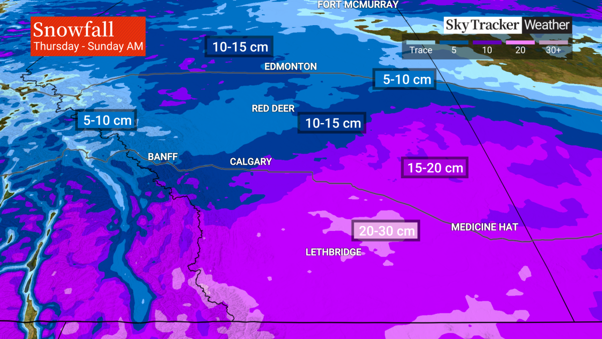
The first round of snow is expected to bring another five cm of the white stuff to the Calgary region, but “we could see another 10-15 cm of snow fall in the Calgary area before we make it to Saturday night.”
After receiving a snowfall overnight Thursday, the Edmonton area is also forecast to get up to 15 cm of snow.
Southern Alberta and the Lethbridge area will be the hardest hit, Lizee said, adding up to 30 cm of snow is in the forecast by Sunday morning.
The Medicine Hat area will also see periods of heavy snow, up to 20 cm by the time the third wave of snow rolls through.

“While parts of the province may see around 15-30 cm of snow by Sunday, the rate of snowfall may not be enough to get snowfall advisories,” said Global Edmonton weather specialist Phil Darlington. “Snowfall warnings are issued in Alberta when 10 cm or more falls in 12 hours or less.”

Get breaking National news
“The far southwest of the province may also see some localized pockets of heavy snowfall that surpasses that of surrounding regions because of some upslope,” adds Darlington.
“That is when moist air is forced to rise as it is pushed up a mountain causing it to cool and precipitate.”
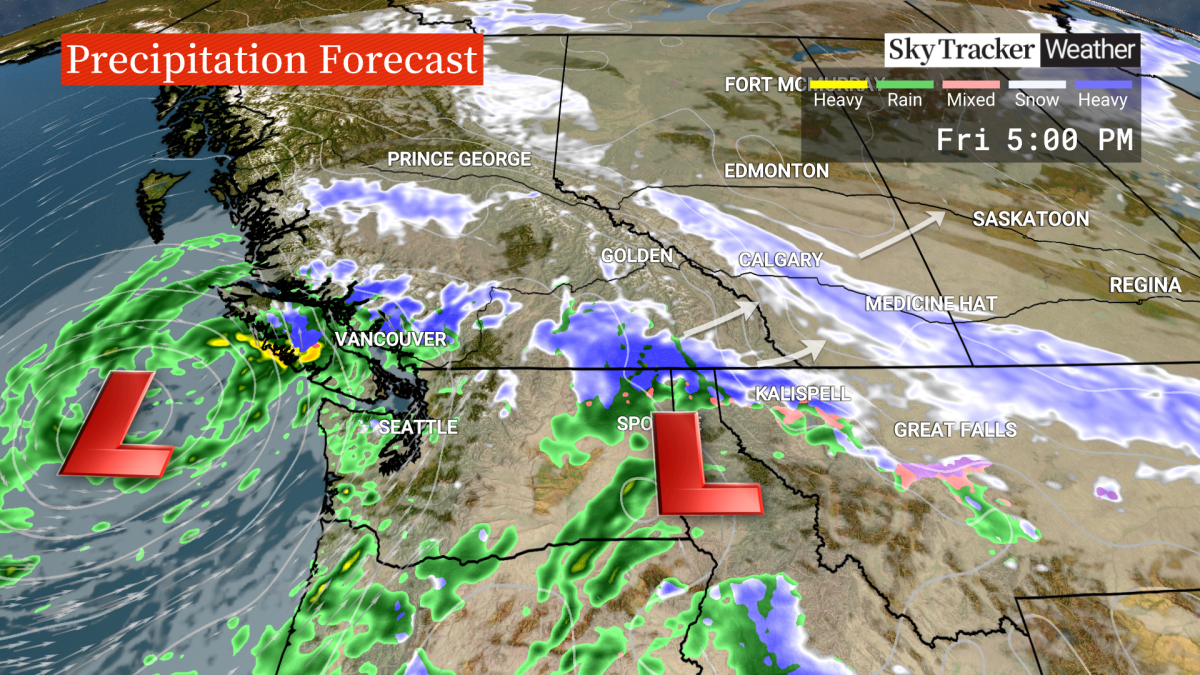
The weather system is moving in from the Pacific Ocean.
“Much of the winter weather can be blamed on the same system that slammed into Vancouver Island the southwestern B.C. earlier this week, bringing heavy rains, forced the closure of roads, toppled trees and power lines and left hundreds of thousands of people without power,” says Lizee.
“The Pacific bomb cyclone that impacted B.C. earlier this week tapped into an atmospheric river.”
That subtropical moisture is now feeding a new system pushing more moisture and energy into B.C. and the Pacific Northwest, Lizee said.
“That will be enough to fuel another low just south of us in Montana, which will push northeast, bringing rounds of heavy snow into Alberta starting on Friday,” she added.

While Alberta won’t get the heavy winds experienced in B.C., “we do expect winds to pickup as this system exits the province,” said Lizee.
“Calgary could see strong northwesterly gusts up to 50 km/hr Saturday night.”
The temperatures will also be very chilly with the mercury in Edmonton plummeting to -23 C overnight on Sunday and the daytime high only reaching -15 C.
In Calgary the temperature overnight Sunday is forecast to hit -20 C with a daytime high of -12 C.
The normal overnight temperature in Calgary at this time of year is -11 C and the normal daytime high is a relatively balmy -1 C.
Lizee said this is just the beginning.
“We do expect a La Nina winter and that does mean more snow and unfortunately, more cold to come.”
Want your weather on the go? Download Global News’ Skytracker weather app for iPhone, iPad and Android.


Comments
Want to discuss? Please read our Commenting Policy first.