

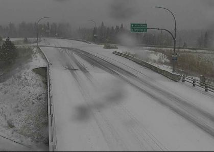
After some glorious weather so far this fall in Alberta, there’s a dramatic shift in the forecast on the way — including the possibility of several centimetres of the dreaded white stuff early next week.

On Saturday, the temperature in Calgary and Edmonton is forecast to hit the mid to high teens, but the mercury is expected to plunge by Monday with the forecast high just barely above freezing.
In Lethbridge, the temperature could hit the mid-twenties this weekend before it drops to around 6 C on Monday.
“Temperatures over the weekend will take a big jump thanks to Chinook winds moving in from the west,” Global Calgary chief meteorologist Tiffany Lizee said on Friday.
“Areas in southern Alberta are expected to reach the high teens, low 20s C.”
But by Monday, we’ll see a dramatic shift in the weather.

Get daily National news
“Snow will move into the Rockies and parts of northern Alberta over the weekend,” Lizee said.
“Areas in the capital region will start to see mixed precipitation on Sunday, which will eventually push farther south to Calgary on Monday. Lethbridge will also get some moisture, but that should stay as rain.”
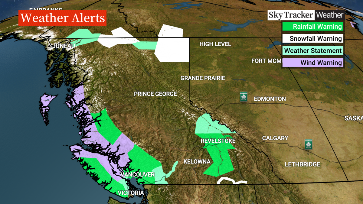
Lizee says a big weather system moving in from B.C. is to blame.
“There’s a low-pressure system that’s built up over the Pacific. It’s being fueled by an atmospheric river that’s pulling subtropical moisture north and into Western Canada,” Lizee said.

The change in weather means anyone planning to hit the road to B.C. must be prepared.
A snowfall warning has been issued for parts of Highway 3 through the Kootenay pass, with up to 15 cm of snow expected overnight Friday before it turns to rain on Saturday morning.
A heavy rainfall warning has been issued for Highway 1 (Trans Canada Highway) with up to 80 mm of rain expected beginning Friday afternoon before it tapers off Sunday.
The rain will be so heavy at times that motorists are being warned of the possibility of localized flooding and washouts near rivers, creeks and culverts.
A special weather statement is in place for the Coquihalla (Highway 5) beginning Friday through Sunday, where up to 60 mm of prolonged rain could cause water pooling on the road, washouts and landslides. Gusty winds are also expected.
For safety reasons, anyone driving into B.C. along the mountain highways or through high snowfall areas is also required to have winter tires on their vehicle or carry chains.
The law is in effect from Oct. 1 to April 30 each year and any motorists who aren’t properly equipped can face fines or be turned away.
For updates on road conditions, visit 511 Alberta and DriveBC.


Comments
Want to discuss? Please read our Commenting Policy first.