


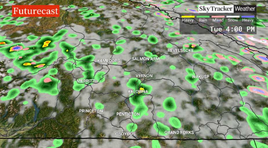
After a wet start to the week on Monday, a chance of thunderstorms will roll in Monday afternoon as temperatures climb to the teens.

Gusty winds are expected into the evening as a cold front slides through before clearing overnight as the risk of storms diminishes.
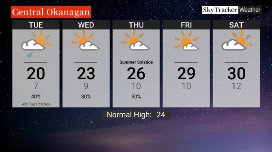
Tuesday will start out on a sunny note with single-digit temperatures and the risk of early-day fog patches before the mercury climbs toward the 20s C with a chance of a late-day shower.

Get breaking National news
Wednesday will be even warmer with a daytime high a few degrees into the 20s C before mid-20s C are reached Thursday with a chance of a late-day sprinkle both days under partly cloudy skies.
Summer officially begins Thursday afternoon around 1:51 p.m. with the first full day of summer on Friday seeing sunshine and the mercury climbing into the upper 20s C.
If the 30s C aren’t reached on Friday, they likely will on Saturday as clouds roll in and linger on a slightly cooler Sunday.
- Storm to bring up to 60 millimetres of rain to parts of Ontario, Quebec
- A ferocious Hurricane Simon nears Mexico with 155 mph winds and flooding fears
- Simon strengthens into a Category 4 hurricane as it approaches Mexico’s coast
- Isaias weakens but flash flooding threat persist as hundred of thousands grapple with power outages


For weather on the go download the Global News SkyTracker Weather App for iPhone, iPad or Android.


Comments
Want to discuss? Please read our Commenting Policy first.