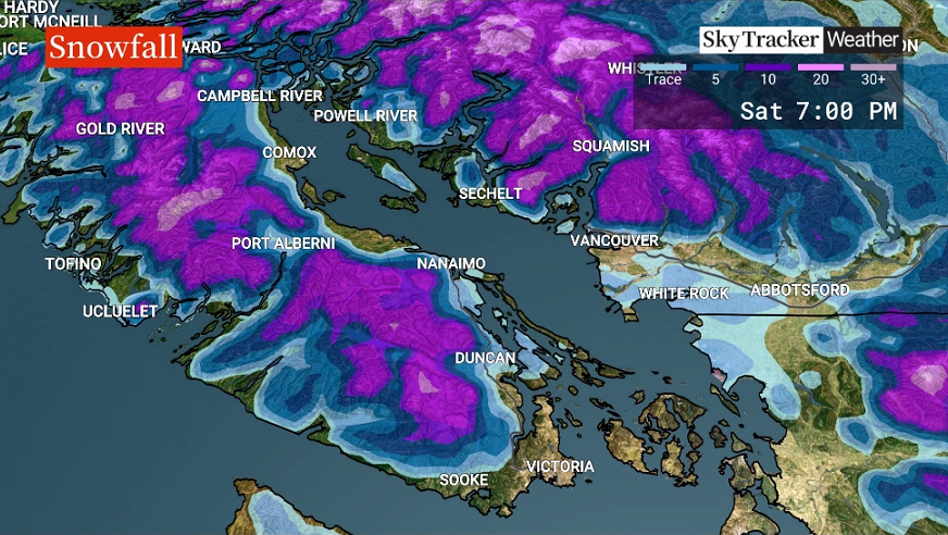
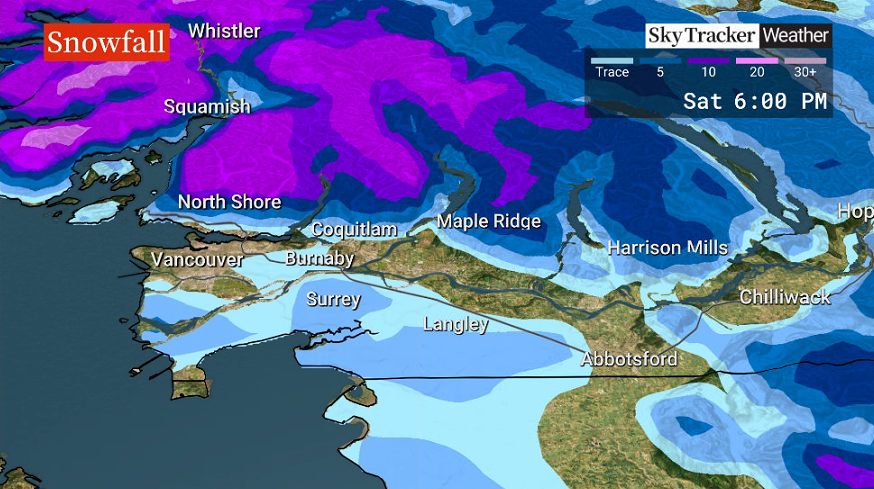
Heads up to all the Christmas shoppers and drivers out there: snow, or wet snow, is possible Saturday afternoon in parts of the Lower Mainland and Vancouver Island.

Saturday morning, a frontal system will bring rain to the South Coast. Temperatures at this time will be close to 4 C.
Sometime between 12 p.m. and 6 p.m., a brief cooling over some lower-elevation regions is possible. Rain could transition to snow or wet snow for a few hours in some areas.
Precipitation will be heavy during this time, so travellers need to be aware that the rapid accumulation of snow or wet snow is possible. The roads could become a snowy and/or slushy slippery mess very quickly.
As always with B.C. South Coast snowfall, the amount of snow will be highly variable from region to region. Some areas may receive just rain if temperatures remain just above freezing.

Get breaking National news
However, some areas below 200 metres across the Lower Mainland could see anywhere from no accumulations to six centimetres of snow in just a few hours. Higher elevations of the Lower Mainland could receive up to 10 centimetres.
- Old Man Winter wallops B.C.’s Mainland/Southwest region, major highway closed
- Calgary hit by unexpected blast of spring snow, causing dozens of crashes
- False spring strikes again: Saskatchewan prepares for incoming winter weather
- Albertans’ interest in alternative forms of travel growing as fuel prices spike
Five to 15 centimetres is possible along Highway 4, near Port Alberni, while zero to five centimetres is possible from Courtenay down to Nanaimo through the Cowichan Valley and over the Malahat.
This forecast has the potential of changing as we get closer to the event so make sure to tune back in before heading out on the roads.
The snow will melt away with rainfall in the evening once temperatures warm. Sunday will be mild with periods of rain.


Comments
Want to discuss? Please read our Commenting Policy first.