
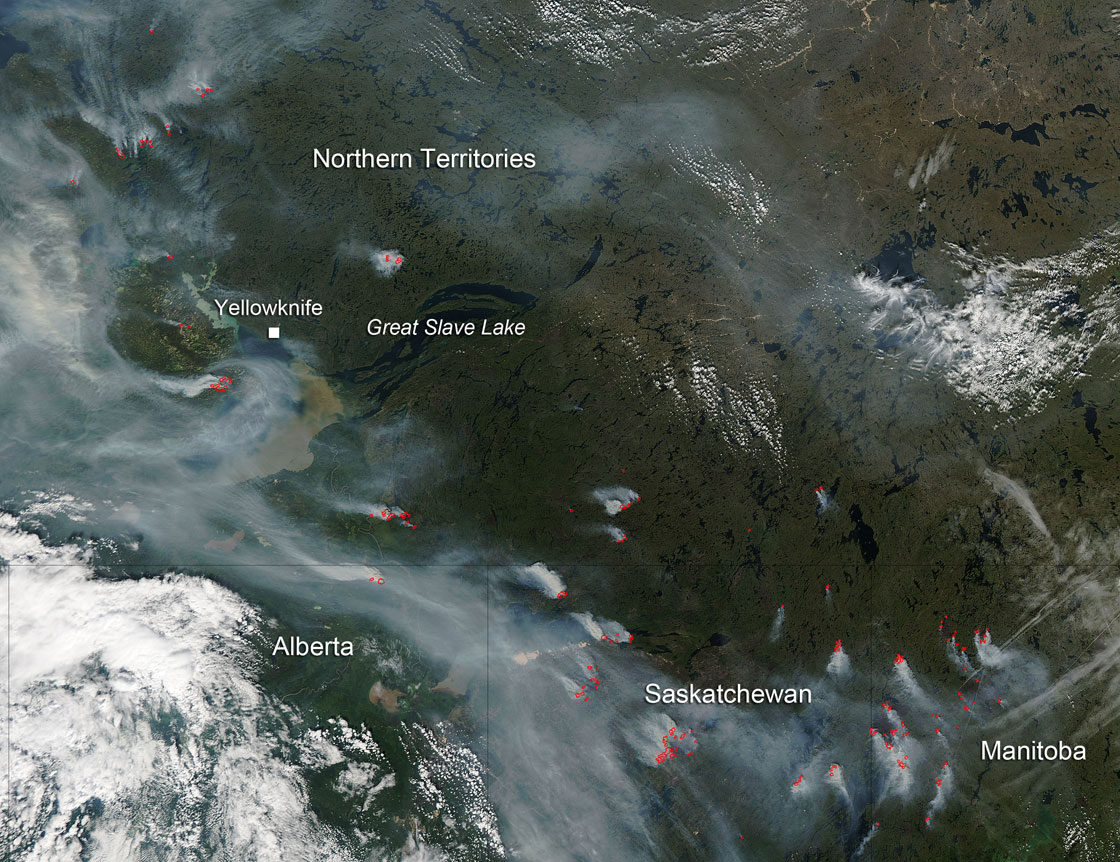
TORONTO – A NASA satellite has photographed fires burning across central Canada.

The fires — in the Northwest Territories, Alberta, Saskatchewan and Manitoba — were imaged using the Aqua satellite on Aug. 12.

Get breaking National news
For news impacting Canada and around the world, sign up for breaking news alerts delivered directly to you when they happen.
By providing your email address, you have read and agree to Global News' Terms and Conditions and Privacy Policy.
Over the past week, 508 new fires have started across the country. More than 208,000 hectares of forest have been burned, with most of them occurring from Manitoba westward.
In British Columbia and the Northwest Territories, the fire danger is high to extreme.
Though seasonal fire occurrence is below average, the area that has been burned is nearly double the 10-year average.
Comments