
Environment Canada has issued a severe thunderstorm watch for several areas in B.C.’s southern interior.

The agency says that conditions are favourable for the development of severe thunderstorms that may be capable of producing strong wind gusts and heavy rain.
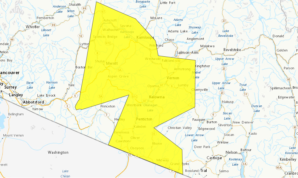
The watch is in effect throughout the Okanagan Valley including in Kelowna, Vernon and Penticton. It was also issued for the South Thompson as well as Boundary and Nicola regions.
Forecasters say the primary hazard will be slow-moving thunderstorms that could produce heavy rain nearing 15 to 20 mm per hour. Heavy downpours can produce flash floods and water pooling on roads.
Environment Canada is advising people to be cautious when thunderstorms are active.

Get breaking National news
“Lightning kills and injures Canadians every year. Remember, when thunder roars, go indoors.”
Severe thunderstorm watches are issued when atmospheric conditions are favourable for the development of thunderstorms that could produce one or more of the following: large hail, damaging winds, torrential rainfall.


The BC Wildfire Service says concerns could arise when a thunderstorm watch or warning is issued, however, there are other factors to go along with it.
“The risk would be whether or not any lightning that we receive comes with an adequate amount of precipitation to go with it. Typically when you have dry lightning you can have more potential to see wildfires pop up. If you’re getting a decent amount of precipitation that chance will be lessened, not impossible,” said BCWS fire information officer Melanie Bibeau.
Bibeau says there isn’t a specific amount of rain which would lower the risk, it’s mainly dependent on current weather conditions.
“What our buildup index is like, what type of fuels are in the area along with the fire danger rating that we’re seeing throughout the fire center as well, because that does differ depending on where in the center you are located,” Bibeau said.
Comments
Want to discuss? Please read our Commenting Policy first.