
A weekend filled with precipitation didn’t change the snowpack level in the Okanagan.

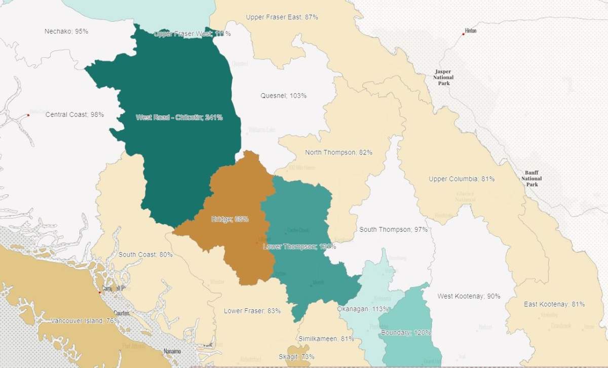
On April 1, B.C.’s River Forecast Centre (RFC) listed the region’s snowpack level at 113 per cent of normal, a stat that remained the same on Wednesday.
To the east, Wednesday’s data had the Boundary region at 120 per cent, the same as it was two weeks ago.
The Similkameen region stayed steady at 81 per cent, while the West Kootenay was also steady at 90 per cent.
Provincially, most regions are below their normal levels, with only eight at 100 per cent or more. Six of those are in B.C.’s Interior, with West Road-Chilcotin topping out the list at 241 per cent.
The Lower Thompson region is next at 131 per cent, and is followed by Boundary (120), Okanagan (113), Upper Fraser West (111), Nicola (109), Quesnel (103) and Fraser River at Hope (100).

- Remains of dinosaur skull found in B.C. campground belonged to T. rex ‘great-uncle’
- Close to 200 wildfires are active in northern Ontario, as communities evacuate
- Ontario MPP charged riding association for restaurants, hotels and limo rental
- 2 boys missing after being swept into rapids at Manitoba provincial park


The RFC said March was cool and dry throughout the province, but added that “above-normal snow indicates a higher risk for snowmelt-related spring flooding for the Upper Fraser West, Chilcotin, Okanagan, Lower Thompson and Boundary basins.”

Get daily National news
April’s snow survey and water supply bulletin is available online.

Comments
Want to discuss? Please read our Commenting Policy first.