

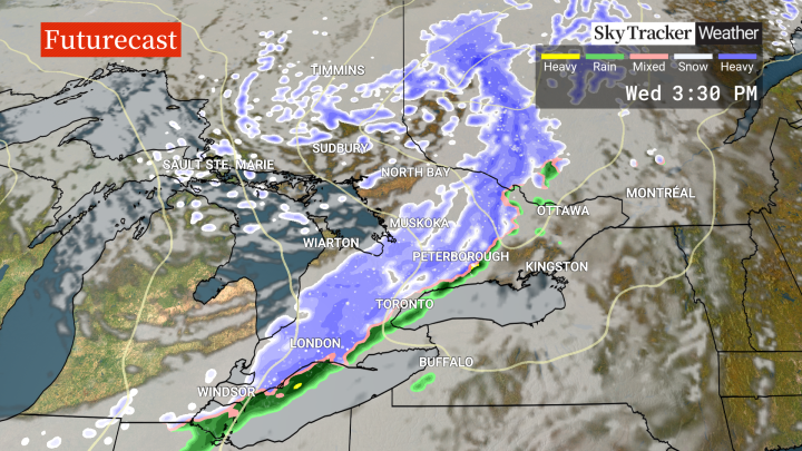
An Arctic cold front will sweep across southern Ontario on Wednesday, bringing with it a big drop in temperature and a brief burst of heavy snow.

Global News meteorologist Anthony Farnell said the region will have a “quick taste of seasons past” when the front races through.
Much of southern Ontario is under a winter weather travel advisory issued by Environment Canada, which warns of possible slippery conditions.
“It feels like spring this morning, but by dinnertime in the GTA, the wind chill will be near -10 and will drop even lower overnight tonight,” he said.
“As this front moves through, a narrow band of rain will quickly transition to heavy snow with near-zero visibility. It’s a situation where you could look out your window one minute and everything looks normal and then the next it’s a full-on snow globe outside.”
Farnell said winds could gust as high as 70 km/h and there could be the odd thunder and lightning strike.
But the precipitation won’t last long, he noted, with sunshine returning behind the front later Wednesday.

Get daily National news
The winds will slowly diminish by Thursday morning and by the afternoon, temperatures will be well above freezing once again for much of southern Ontario.
Looking further ahead, Farnell said the next storm “will be a doozy.”
“While our neighbours to the south deal with another major severe weather outbreak, it looks like two days of rain Friday and Saturday around the Great Lakes,” he said.
“A widespread 20 to 40 mm is expected to fall, but for areas from Sault Ste. Marie to North Bay, this will likely fall as snow with up to 40 cm on the way.”
Overall, a wet and seasonal-to-cool weather pattern is expected through the first half of April.


Comments
Want to discuss? Please read our Commenting Policy first.