After the cloudiest (darkest) winter in almost 80 years, the sun is shining more often again and you can’t help but smile when you are outside after 7 p.m. and it’s still bright out.

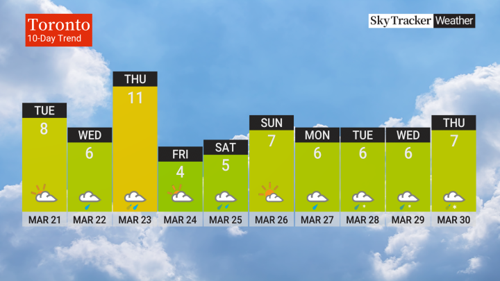
While average temperatures continue to climb about a degree every four or five days, the actual temperature will feel like it’s stuck on replay for at least the next couple weeks across southern Ontario.
I’m not saying we won’t see double-digit days through mid-April, but they will be few and far between in places like the GTA.
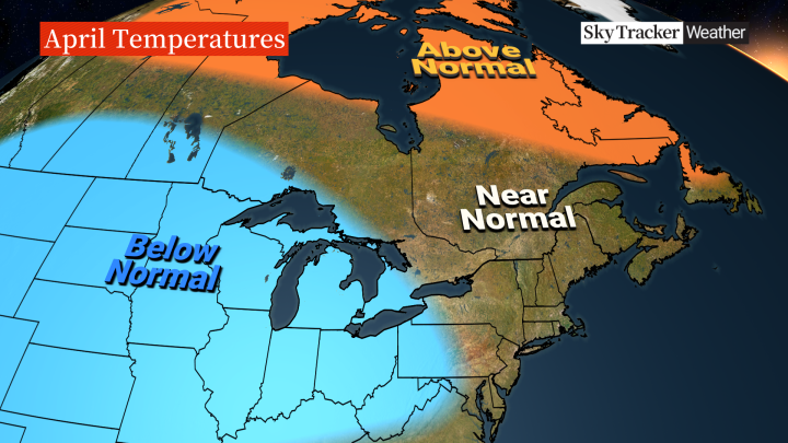
We’re still working through a pattern that favours leftover winter chill for much of North America.
It’s also looking like above normal rainfall will continue through the next month.
You know what they say about April showers? I’m not sure what they say about April snow, but there’s a higher than normal likelihood of at least one more snowstorm in the next few weeks.
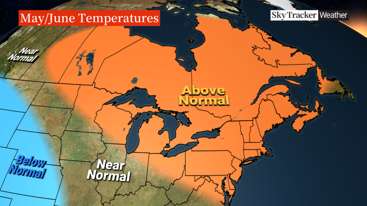
After what should be a cooler and wetter than normal April, we are likely to see a complete reversal sometime in May.
It may be another one of those “suddenly summer” years that seem to occur more often recently.
May is the transition month, but June could turn quite hot and humid across southern Ontario.
The good news early in the season is that you can always find some relief down by the water.
The Great Lakes are large bodies of water that take much longer to warm up compared to land, so cool lake breezes are very common, especially in May and June.
It’s hard to predict if we are going to get an early start on the severe thunderstorm season around here, but with more heat and humidity to play with in late spring, the storms that do form will likely be stronger than usual.
Early indications point to a hot and humid summer across southern Ontario.


Comments