
A mix of sun and cloud will linger throughout the Okanagan on Thursday, with temperatures reaching high, single digits before a wave of clouds roll in for the night.

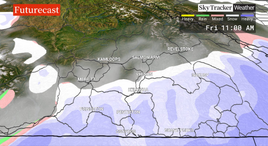
A system swinging through Washington state will kick up snow into the South Okanagan on Friday, with some likely to push into the Central Okanagan during the day as well.
As a result, temperatures will be cooler throughout the day, struggling to get above the freezing mark with a few centimetres of snow in southern sections.

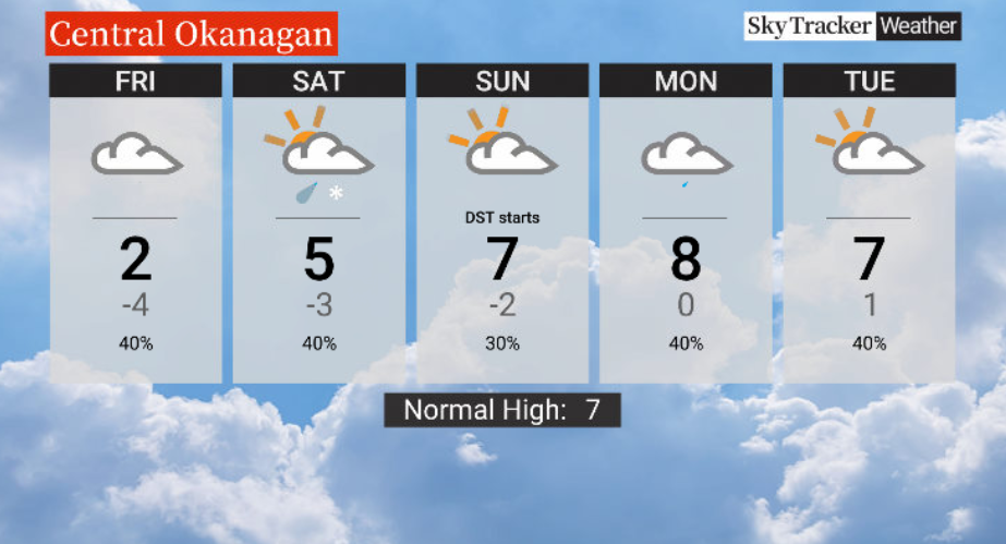
Conditions will be calmer for the weekend, though Saturday could see a slight risk of rain with pockets of precipitation. Temperatures should also reach the mid-single digits.
Don’t forget to turn your clocks back to Daylight Saving Time before going to bed on Saturday night.


Get breaking National news
Sunday will be mostly cloudy with an afternoon high around 7 C.
Showers return for the workweek ahead — the final week of winter — with afternoon highs in the mid-to-upper single digits.
For weather on the go download the Global News SkyTracker Weather App for iPhone, iPad or Android.
Comments
Want to discuss? Please read our Commenting Policy first.