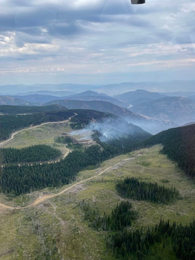
The Keremeos Creek wildfire located 21 kilometres southwest of Penticton has grown slightly over the last two days, burning a total of 7,042 hectares.

In an update Sunday morning, BC Wildfire Service says the fire’s behaviour continues to be “wind-driven.” With cooler temperatures, moderate humidity and thunderstorms in the forecast, BCWS is expecting winds to increase. However, the light rain that fell Saturday evening likely decreased fire behaviour.
“In many areas, forest fuels at high elevations are green, and the moisture content is preventing ignition and spread. Dead and fallen trees continue to burn at high elevations on steep slopes,” BCWS said in an update.
The 100-hectare growth is attributed to wind at high elevations and two planned ignitions conducted on Aug. 16 and 17. The fire remains stable along the western side of Highway 3A.
Crews continue to extinguish hot spots found on the thermal aerial scans. BCWS plans to use a drone on Monday night to get an updated aerial scan.

Get daily National news
Improved fire conditions allowed the wildfire service to complete a patrol and demobilize all equipment from Sheep Creek Road to Highway 3A.
People most at risk of the Keremeos Creek wildfire were given the go-ahead to return home earlier in the week, despite the fire remaining out of control.
“Smoke will continue to be visible from Highway 3A and surrounding communities until there is significant rainfall, which is common with large wildfires,” said BC wildfire.
Smoke appearing from well within the fire perimeter is expected. However, they noted smoke that rises from green, unburned fuel or from outside of the fire’s perimeter should be reported.
To report a wildfire or open burning violation, call 1 800 663-5555 toll-free or *5555 on a cellphone.


Comments
Want to discuss? Please read our Commenting Policy first.