

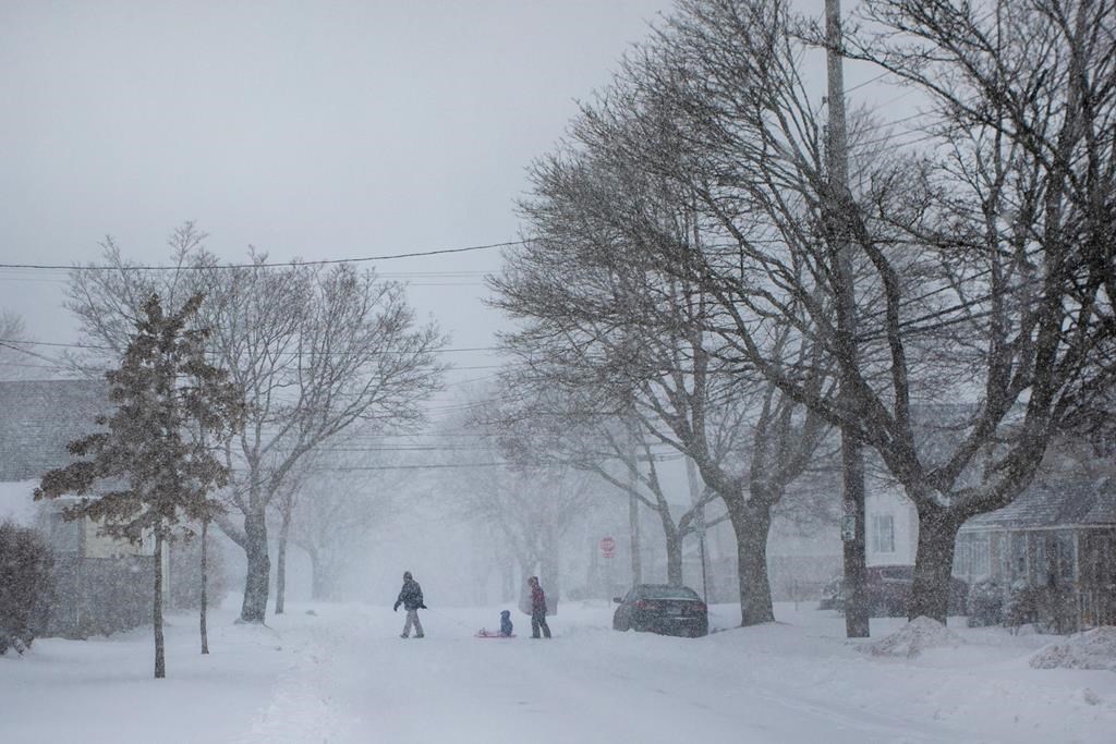
Manitobans still uncertain about removing their winter tires may have their minds made up for them this week.

Environment Canada says a Colorado low will arrive in southern Manitoba on Tuesday night, bringing with it between 20 to 40 centimeters of snow that will continue into Wednesday.
The weather service’s special weather statement, issued Sunday morning includes the City of Winnipeg and stretches as far north as Grand Rapids and Poplar River.
It says areas near the Canada-U.S. border could see as much as 60 centimeters of snow.
Additionally, wind speeds between 60 and 70 kilometers an hour, at times gusting up to 80 kilometers an hour in the Red River Valley, are likely Wednesday night and into Thursday.
Environment Canada cautions this will lead to widespread visibility issues and dicey travel conditions.
The system is expected to ease Friday as the heaviest snow makes its way into Ontario.

Get daily National news
“It’s going to be brutal,” weather expert Bruce Johnson told 680 CJOB Sunday.
“Right now, it’s showing we’re going to be more on the snow side than the rain side.
“If that’s correct, we’ll get a big dump of snow, which agriculturally is good, but it’s going to be annoying. And the wind is going to be absolutely horrible probably Wednesday and Thursday.”
Johnson says the system is a result of an unusually warm air mass and an unusually cool air mass slamming into each other over the northwestern United States, “a classic set-up for a winter storm.”
“If you remember October of 2019, this reminds me quite a bit of that,” Johnson said.
“Of course, the worst of that was west of Winnipeg, but Winnipeg got 34 centimeters (of snow) out of that. Some places got double that, and this one looks pretty much on that scale, maybe even stronger.”


That said, Environment Canada notes the system could still deviate from its path, which could “significantly change” projected snowfall totals, wind speed and the type of precipitation.
It’s still unclear how the storm may affect overland flooding in Manitoba, with the province saying Saturday runoff isn’t expected to start until after April 20.
“Flood forecasters will continue to monitor the system and its impact on flows and river levels as the system develops and progresses throughout the week,” the province said in a press release.
That update also noted water levels are rising on the Assiniboine River between the Shellmouth Dam and Winnipeg, and are expected to peak within the next week.
But, levels were still forecast to remain below bank capacity at all locations.

Comments
Want to discuss? Please read our Commenting Policy first.