If extreme flooding and wildfires weren’t enough for the Northwest Territories in 2021, another extraordinary weather event snuck by almost unnoticed – unless you were a tree.

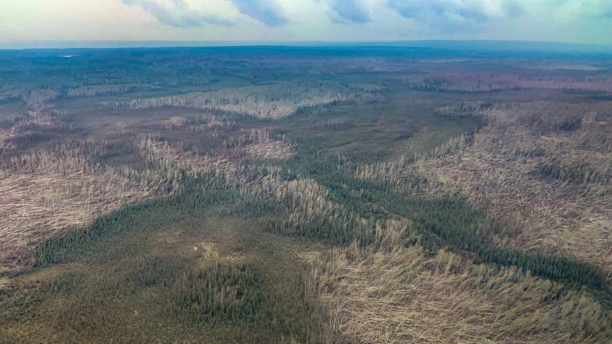
A downburst, one of the first ever recorded in the N.W.T., ripped through a patch of trees some 60 kilometres long and nine kilometres wide when it struck the Dehcho region, east of Fort Liard, on June 29.
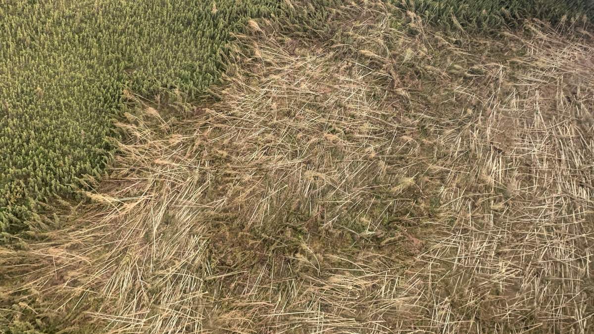
Photographed from the air, the devastation made entire sections of forest look more like dried grass.
Details of the event were reported this week for the first time by the Northern Tornadoes Project.
A downburst is not a tornado, but its aftermath can look a lot like a tornado passed through.
Downbursts are powerful and fast storms with strong winds accompanied by rain, thunder, lightning and occasionally hail. Air rushing down from the storm spreads out in unusually destructive fashion, causing the damage to trees seen on June 29.
Wind speeds during the Dehcho storm reached up to 190 kilometres per hour, researchers believe. The downburst registered as the equivalent of an EF-2 tornado on the Enhanced Fujita scale, a measurement of wind damage intensity where the lightest is EF-0 and the most severe is EF-5.
“To have an event of this magnitude up there? I think it may be the first of its kind,” said David Sills at Western University, executive director of the Northern Tornadoes Project.
“I don’t know of any other records of a very large blowdown like this happening up that way,” said Sills. “Usually we don’t see a downburst that large.”

The end of June 2021 brought extreme heat to western Canada and parts of the United States. The day of the downburst was also the day Lytton, B.C., set a Canadian temperature record of 49.6 C.

Get daily National news
“With these kinds of events occurring farther south, that pushes the thunderstorm track farther north than it would normally be,” said Sills.
“You get events like that along the north side of all this hot air, affecting places like the Northwest Territories and northern Alberta and B.C.”
Sills said his team discovered the Dehcho event after Environment and Climate Change Canada reported significant tree damage.
While only one downburst event will enter the record for the N.W.T. on June 29, Sills says aerial images suggest a cluster of individual wind bursts were responsible for the damage.
“You see a series of these fan-shaped patterns in the trees. Each of them is that wind from the thunderstorm, air from the thunderstorm, descending and spreading out,” he said.
“It’s all connected. They’re just single spots but they’re part of a large area of damage. We’ve drawn a line around all of these, where all the damage occurred, and said this was one downburst.”

Northern Alberta and British Columbia, also on the northern edge of the summer heat dome, had similar downbursts the next day.
“There were 31 similar downbursts in northeast Alberta and northwest B.C., so an even larger area of wind damage in that region,” Sills said.
“To have that intensity of storms that far north, creating that kind of damage, is not something we’ve seen before.”

Importance of recording downbursts
The Northern Tornadoes Project only started logging downbursts in 2019. Sills thinks the Dehcho event could be the first of its kind ever recorded in the territory.
The only other weather event the project has recorded in the N.W.T. is a tornado in Fort Smith in 2019.
“Certainly since 2019 we haven’t seen any downburst activity in the N.W.T.,” Sills said. “I’d say this is fairly rare up in this area.”
Sills said he worked as a severe weather scientist for the federal government for more than 20 years prior to joining the Northern Tornadoes Project and could not recall any downbursts similar to the June 29 event near Fort Liard.
However, the sheer vastness of the territory and its lack of population mean downbursts could have happened in the past without being reported.
“As you can see from this kind of event, it can have a really big impact on forests,” said Sills. “If this had hit a populated area, obviously, it would have caused damage as well.”
In this case, the damage was so significant that the downburst was identified. Sills says that’s important because the downed trees could act as fuel for future forest fires, but can now be monitored.


Comments
Want to discuss? Please read our Commenting Policy first.