

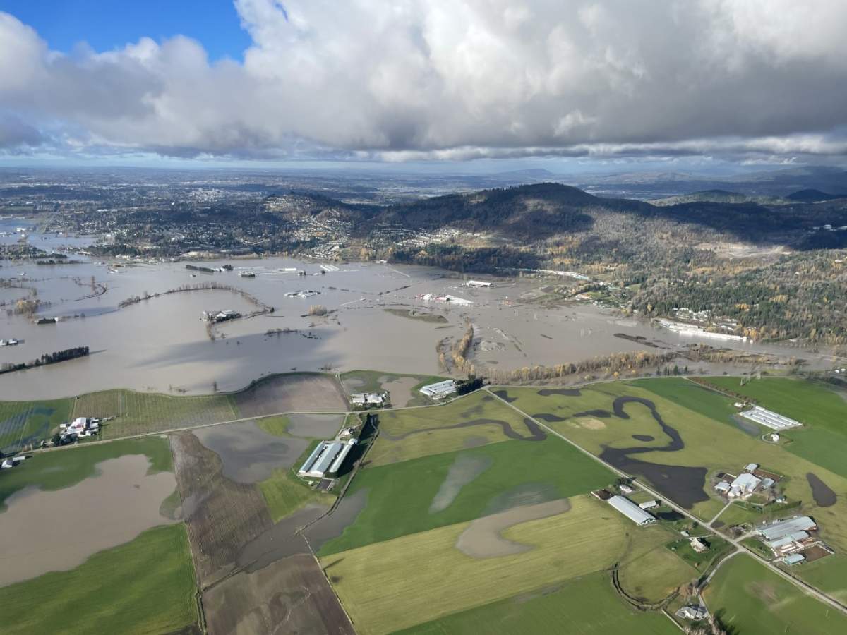
B.C.’s south coast and parts of the Interior received a month’s worth of rain in about two days earlier this week and the damage has been catastrophic.

A woman from the Lower Mainland died in a mudslide, which struck north of Pemberton on Monday.
It is believed three people are still missing.
In addition, homes have been lost, roads and bridges swept away and thousands of animals have died.
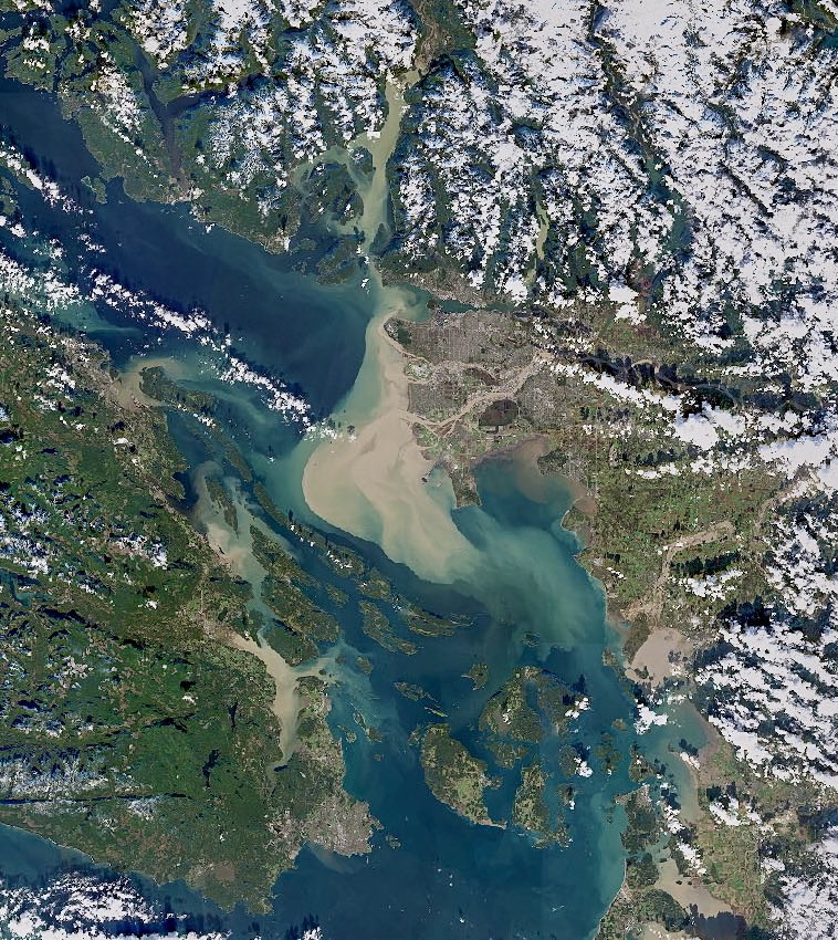
The impact was so huge it could be seen from space.
A photo from NASA, shared by Canadian astronaut Chris Hadfield, shows the massive amount of runoff of topsoil and silt into the Fraser River.
Vancouver and the Lower Mainland can be seen to the right of the runoff.
The photo was shared on Nov. 17.

Photos and videos taken from the air also highlight how much the atmospheric river affected so many parts of the province.


Comments
Want to discuss? Please read our Commenting Policy first.