
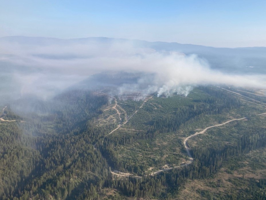
The firefight continues in B.C.’s Southern Interior, and it’s believed several of the out-of-control wildfires are bigger than what’s being currently reported.

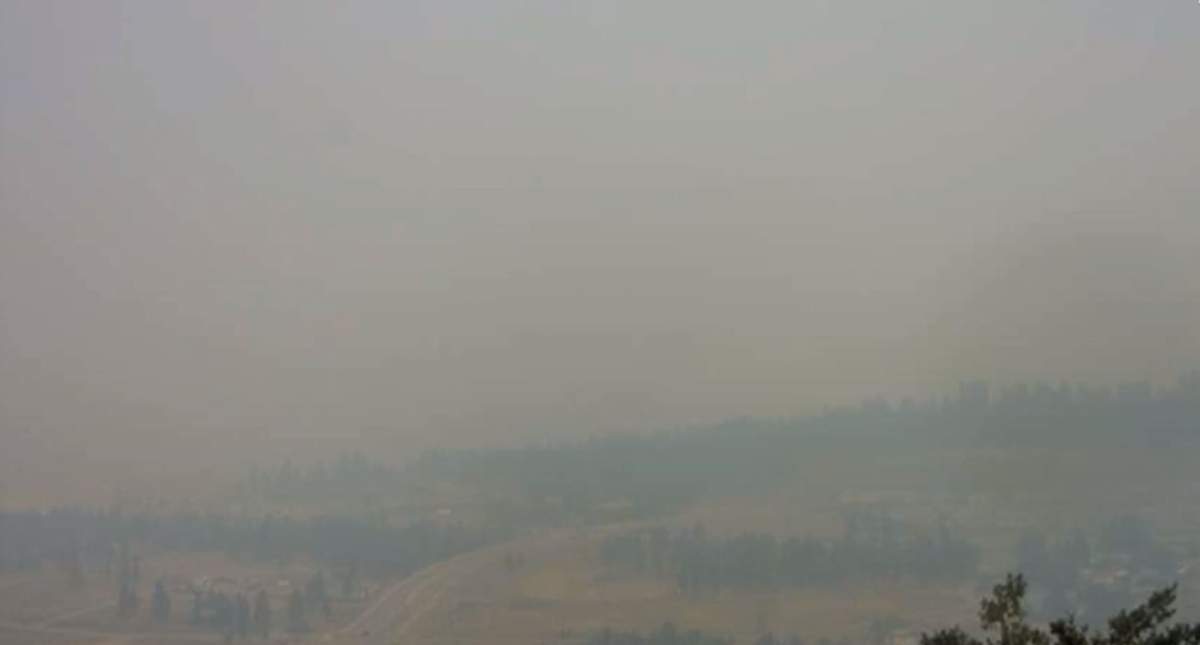
According to the BC Wildfire Service, smoky conditions and windy skies are preventing accurate wildfire mapping.
“We are experiencing (smoky conditions) on a number of our fires,” BC Wildfire information officer Noelle Kekula told Global News on Tuesday.
As was the case for some fires last week, smoky skies are preventing aerial crews from properly obtaining size estimates.
Below is a list of wildfires of note throughout the Southern Interior.

South Okanagan
Nk’Mip Creek
The Nk’Mip Creek wildfire that’s burning north of Osoyoos continues to grow according to the BC Wildfire Service, but accurate tracking has been challenging due to aggressive fire behaviour and smoky conditions.
At last word, the fire was pegged at 6,800 hectares.
There are 141 firefighters battling the out-of-control blaze, and heavy equipment has been able to make good progress. Also, another 100 firefighters from Mexico have joined the suppression efforts.
Evacuation orders and alerts remain in place, though the Regional District of Okanagan-Similkameen rescinded an evacuation order for eight properties on Tuesday afternoon that are now under evacuation alert.
According to the Regional District of Kootenay Boundary (RDKB), fire behaviour was steady on Monday night and operations were normal.
Further, heavy machinery made good progress along the east contingency line (Mt. Baldy/Sidley Meadow areas) and the fire remains approximately seven to eight kilometres west of Mt. Baldy.
RDKB also said Shaw internet and TV outages continue between Midway and Christina Lake due to a line burned line.
“Access to the site is restricted due to ongoing wildfire activity,” said the regional district. “Shaw reports that their technicians will undertake repairs when they have clearance to do so from emergency officials and FortisBC.”
Thomas Creek
Approximately 25 km to the north, more than 700 properties remain on evacuation alert due to the Thomas Creek wildfire that’s burning east of Skaha Lake.
The fire is estimated at 7,279 hectares and is classified as out of control.
BC Wildfire says fire behaviour was elevated on Monday in the fire’s north and northeast sections.
Crews and equipment are working to create and reinforce guard lines using existing roads, old fireguards and other natural features. The blaze is estimated at 73-hundred hectares.

Central Okanagan

Get daily National news
Brenda Creek
Fire growth was minimal on the Brenda Creek fire that’s burning south of the Okanagan Connector, about 40 km from West Kelowna.
However, BC Wildfire is expecting an increase in fire activity in the coming days due to hot, dry and windy conditions.
The fire is estimated at 824 hectares and is classified as out of control.
Forty-three properties in the area remain on evacuation order and many more on evacuation alert.
North Okanagan
Bunting Road
In the North Okanagan, the Bunting Road wildfire, located 41 km northeast of Lumby, is estimated at 3,000 hectares.
BC Wildfire says the out-of-control fire near Mabel Lake had overnight growth but was unable to obtain a size update. The fire is burning in deep and steep terrain.
On Monday, the local regional district expanded an evacuation order for the east side of Mabel Lake affecting an additional 34 properties. It also issued an evacuation alert for the area as well, impacting 42 properties.

Shuswap
Two Mile Road
To the northwest, the Two Mile Road fire, burning just two kilometres south of Sicamous, is again listed at 1,000 hectares — as it was during the weekend.
On Monday, an evacuation order for the District of Sicamous was mostly rescinded, allowing residents to breathe a sigh of relief.
However, other orders and alerts are still in place, with the mayor urging residents to be cautious and to be ready to leave at a moment’s notice.
BC Wildfire says crews will continue to build fireguards, and that there was air support throughout the night.
Hunakwa
The Hunakwa wildfire that’s burning southeast of Seymour Arm saw some growth along the east flank last night, but smoke and winds have hampered efforts to map the fire properly.
The fire is estimated at 1,100 hectares and is classified as out of control.


Evacuation orders and alerts remain in place.
Seventeen firefighters and two helicopters are battling the blaze.

Columbia
Three Valley Lake
Southwest of Revelstoke, the Three Valley Lake fire is still listed at 60 hectares and is classified as being out of control.
As with other fires, BC Wildfire said there was overnight growth, but it was unable to provide a size update.
The fire has forced the evacuation of the iconic Three Valley Lake Chateau and adjacent heritage ghost town.
West Kootenay
Michaud Creek
Located on the west side of Lower Arrow Lake, the Michaud Creek wildfire is estimated at 5,981 hectares.
According to BC Wildfire, fire behaviour is expected to remain low to moderate due to lesser winds and smoke that’s covering it from the sun.
However, the wildfire agency said smoke is likely to clear in some localized areas and that fire conditions could rapidly change.
On Monday, an evacuation order for 184 properties in the Edgewood area was downgraded to an evacuation alert.
Octopus Creek
Across the lake is the Octopus Creek wildfire, which is estimated at 14,238 hectares.
Like the nearby Michaud Creek wildfire, smoke is likely to clear in some areas, but conditions could rapidly change.
Evacuation orders remain for Fauquier, north to Grassy Point, including Applegrove.

Thompson-Nicola
White Rock Lake
Burning south of the unincorporated community of Westwold, the White Rock Lake wildfire is estimated at 17,900 hectares.
BC Wildfire says fire behaviour has increased significantly over the last few days due to warm temperatures and increased southwest winds.
Increased fire activity is expected to continue in the coming days, and more structural protection units have been requested, which will include a task force of fire engines that will patrol and action hotspots in an effort to protect properties and high-value assets.
Evacuation orders and alerts remain in place.
Comments
Want to discuss? Please read our Commenting Policy first.