
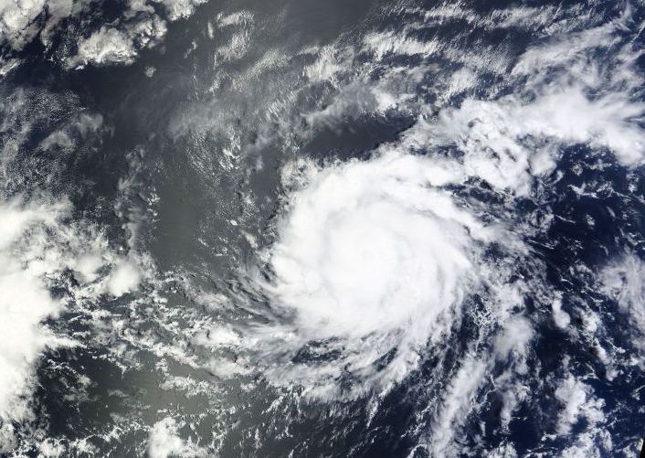
TORONTO – Hurricane Gil has formed in the Pacific Ocean, making it the fifth hurricane of the Pacific season.

Hurricane Gil is moving westward around 20 km/h with sustained winds near 130 km/h and higher gusts. This is the fifth hurricane in the Pacific Ocean this season.
Hurricane-force winds extend outward up to 20 km. The National Hurricane Center out of Miami, Florida, is forecasting some strengthening today, but with a gradual weakening beginning on Friday. There is no threat to land.

Get breaking National news
NASA and the Japan Space Agency’s Tropical Rainfall Measuring Mission (TRMM) satellite captured heavy rainfall just before Gil was upgraded to a hurricane. The powerful storms embedded in Gil are called hot towers, tall cumulonimbus clouds that reach to the top of the troposphere, the lowest layer of our atmosphere. They extend nearly 14.5 km high. NASA research has shown that a tropical storm with a hot tower in its eyewall is twice as likely to intensify within six hours than a storm without one.

Gil is a Category 1 on the Saffir-Simpson Scale which measures the strength of hurricanes. The scale goes from Category 1 to Category 5.


Comments
Want to discuss? Please read our Commenting Policy first.