It’s shaping up to be a stormy couple of days around southern Manitoba with plenty of heat and some humidity to fuel some significant thunderstorms.

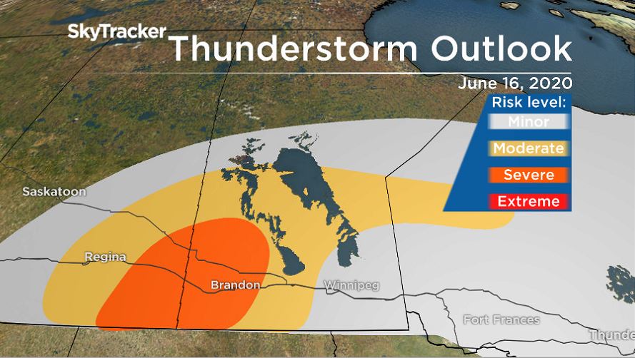
Here is a look at the thunderstorm outlook for Tuesday from Environment and Climate Change Canada.
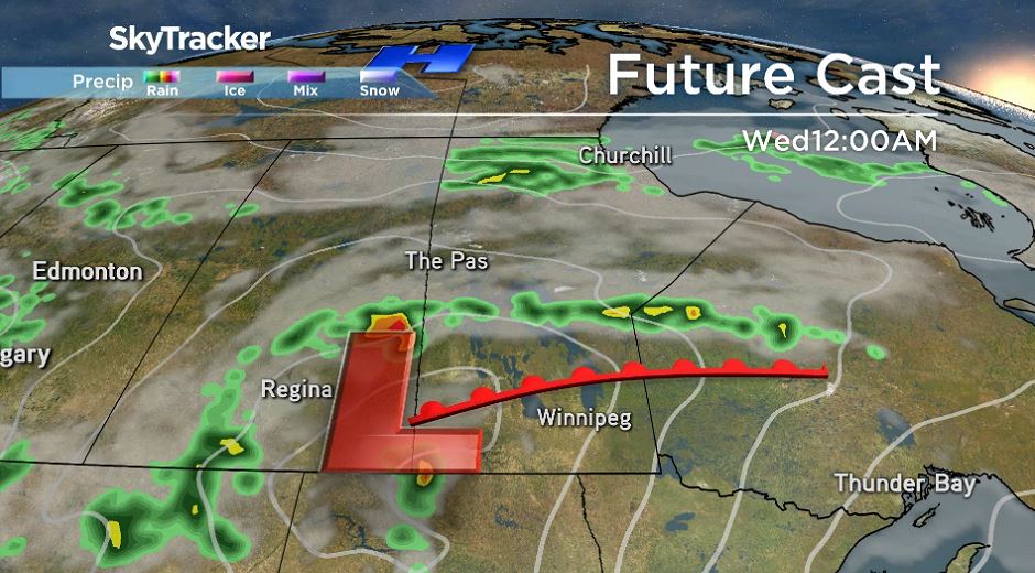
Low pressure moving north from Montana will maintain warm and humid conditions. It will also be near this system and along the warm front where thunderstorm activity will be triggered.
While local forecasts mention a chance of shower and thunderstorm activity during the day around many areas in southern Manitoba, according to Environment and Climate Change Canada the larger, potentially severe storms are more likely to occur in the late afternoon at the earliest and continue into the evening and overnight hours. Large hail (three to five centimetres), damaging winds (gusts to 100 km/h) and heavy downpours are all possible. There is also a slight risk of tornado activity.

Get breaking National news
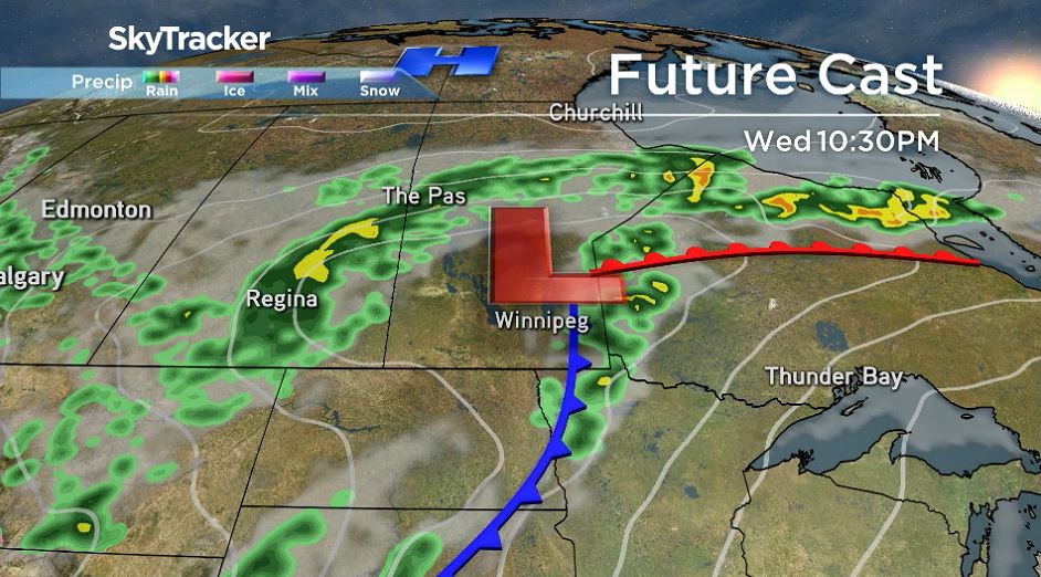
On Wednesday, the focus for larger thunderstorms will move east. A special weather statement is in place as temperatures and humidex values are close to the heat warning criteria. And, with these conditions, thunderstorm activity is possible.
Thunderstorms on Wednesday will be triggered along the cold front from the same system impacting the southwest on Tuesday.
Along the cold front, severe thunderstorm activity will once again be possible with large hail, strong winds and heavy downpours possible. Tornado activity is also possible early in the storm’s development.
Behind the front, rain will likely linger in southern Manitoba but temperatures on Thursday will be noticeably cooler and humidity levels will be lower as well.
- High blood pressure drug recalled over low blood pressure pill mix-up
- ‘Doesn’t make sense’: Union files labour complaint over federal 4-day in-office mandate
- Canadian Tire ordered to pay nearly $1.3 million for false advertising
- Ottawa gives Canada Post a $1.01-billion loan amid ongoing financial struggles


Comments