

To start off the first “summer month”, we’ll see temperatures hit 30° C in Winnipeg for the first time in 2020.

First, a quick look back at May.

There were a lot of cool days last month, including some record breakers. Overall, though, May averaged out to be pretty close to normal, temperature-wise.
The daily mean average temperature in Winnipeg was just slightly below normal at 10.7° C (normal is 11.6°C). And even with most days registering highs that were “below normal”, temperatures also got up to 20° or warmer 14 times, which is just above a typical month (13) based on climate data from 1981-2010 from Environment and Climate Change Canada.

Get breaking National news
So as we get into June, how’s the first day over 30° of 2020 sound? Monday looks like it will also come close to the record high for this day set in 1988. This could mean a few new record highs will be set around southern Manitoba.

The rest of the week will be staying warm — not 30° C, but still above a normal high of 22° C.
There was rain falling overnight and into this Monday morning from low pressure sitting over the eastern prairies. This system will still be around on Tuesday and as a result, there is a slight chance of some showers that pops up Tuesday afternoon in southern Manitoba. There is also the risk of thunderstorm activity at this time.


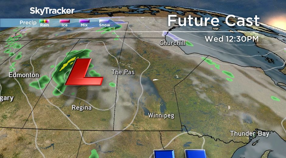
Wednesday there will be another low-pressure system moving towards the eastern prairies that will continue to draw warm southern winds through southern Manitoba. It could potentially lead to a few more scattered showers in Winnipeg but, at this time, it looks like they would be kept to the overnight hours and therefore less likely to result in a big storm for the Winnipeg area.
Behind this system, temperatures will cool slightly but will stay slightly above normal for this time of year.

- High blood pressure drug recalled over low blood pressure pill mix-up
- Canadian Tire ordered to pay nearly $1.3 million for false advertising
- ‘Doesn’t make sense’: Union files labour complaint over federal 4-day in-office mandate
- Ottawa gives Canada Post a $1.01-billion loan amid ongoing financial struggles


Comments