

It was a snowy start to April around southern Manitoba as a result of some very cool air moving into the province. Snowfall was significant and so was the cooler weather.

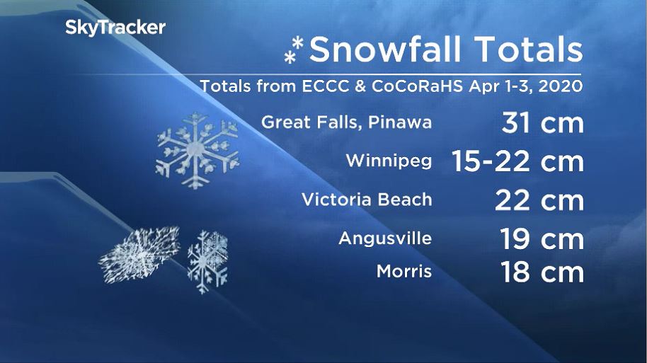
These numbers primarily focus on the southeast but southwestern Manitoba had pretty similar snowfall totals, around 15 to 20 cm.
This snow showed up with some unseasonably cool weather.

After a warm start to the month, temperatures cooled significantly. Friday, the daytime high was almost 15 degrees Celsius below normal.

Get breaking National news
With snow on the ground again, temperatures will warm up more slowly as sunlight will reflect off the white surfaces instead of being absorbed by the ground and radiating heat. As the snow melts, this will allow temperatures to climb more quickly.
This week, there will be more snow in Manitoba. Monday morning, snowfall warnings were put in place for parts of northern Manitoba, where another 10 to 15 cm of snow is expected Monday night and into Tuesday. The effects of the low-pressure system headed to the north will be significantly different around the south. Temperatures will be warmer and instead of heavy snow, a few rain showers are expected.


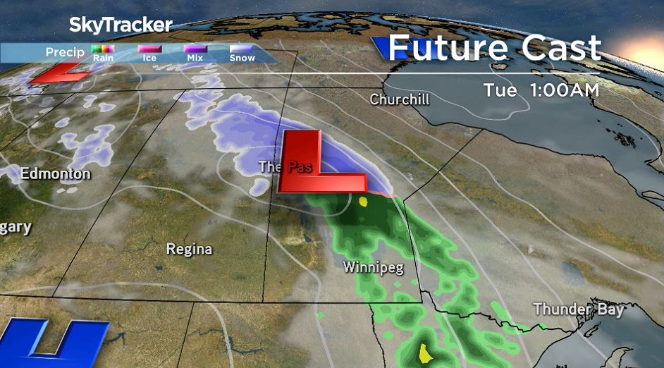
Low pressure in northern will linger around northern Manitoba into Wednesday, where a few more showers and flurries are possible.
Looking later in the week, while more precipitation is possible, no significant rain or snow would be falling. The most notable weather will likely be the cooler temperatures and some windy conditions on Wednesday and Friday.

Comments
Want to discuss? Please read our Commenting Policy first.