

Penticton search and rescue members will carry out a mock evacuation on Monday night to test a new locally-developed app that will assist with the logistics of carrying out mass evacuations.

The app is based on Esri’s Collector for ArcGIS, a mobile data collection app provided by Esri Canada, that was deployed for use by Penticton SAR by the Regional District of Okanagan-Similkameen, the lead agency for emergency management in the South Okanagan and Similkameen region.
The technology will allow search and rescue members to download addresses and maps of the evacuation zones directly to their smartphones.
READ MORE: Penticton wildfire dangerous sign of ‘substantial drought’ conditions in region: BC Wildfire Service
“They have a map for evacuations that covers and shows all the properties and the lot lines through the RDOS, so if we are going up Carmi, it shows us the size of the lots and so you get a pretty good idea of whether you are looking at an acre or 5-10 acres,” SAR manager Dale Jorgensen said on Monday.

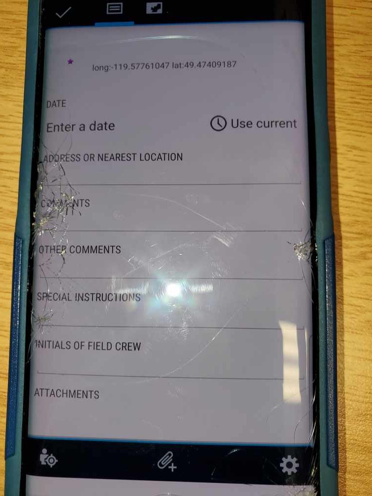
The app also allows search and rescue technicians to upload information from the field– directly to the RDOS Emergency Operations Centre.
Volunteers carrying out the evacuation alerts and orders can notify the command centre if no one is home and if pets need to be evacuated, as well as special circumstances such as language barriers or mobility challenges that require further assistance.

Get breaking National news
Prior to the use of the application, Jorgensen said search and rescue members had to wait for a written copy of the addresses and maps, further delaying deployment.
“Now it’s available virtually instantly to us,” he said.

Natural disasters, such as floods and fires, can also change quickly. If conditions become more severe and the evacuation zones are expanded, the app allows the command centre to communicate that information directly with the search and rescue team on scene.
The new app does require cell phone service, and many of the hardest hit areas in the South Okanagan in recent years have occurred in more remote areas without cell phone capabilities.
Jorgensen said the organization does have its own repeater on Apex Mountain that provides good cell phone coverage from Manning Park to Kelowna, and it also utilizes a device called InReach, supplied by Emergency Management BC.
“It gets us reasonably good coverage and if an emergency arises we could radio back to our command and they could advise the EOC of the situation.”
As flood and fire season approaches, Jorgensen is encouraging residents living in high-risk areas, such as interface fire zones, to be prepared for a short-notice evacuation.
“If they have critical papers, important paperwork or any memorabilia that are absolutely necessary to save and medications, be prepared to be away for abit, have a plan,” he said.
Comments
Want to discuss? Please read our Commenting Policy first.