
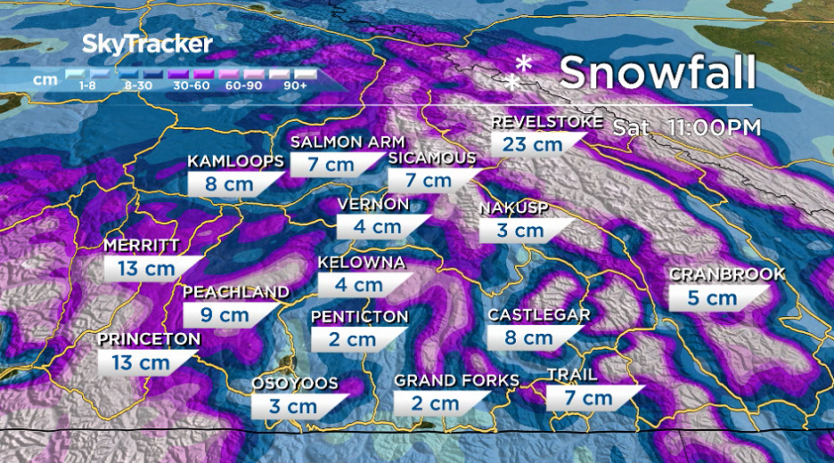
Heading into the weekend before Christmas, the snow that many have been waiting for will be sliding into the Okanagan, Shuswap and Boundary regions.

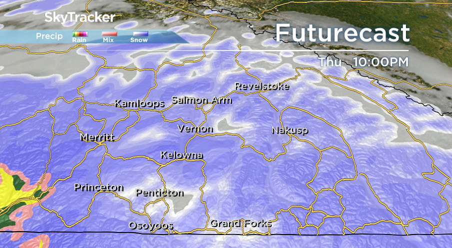
The weather culprit is an atmospheric river that’s bringing in a steady stream of subtropical moisture, with both snow and rain headed for the valley bottom and significant accumulations possible.
Southwest-facing slopes will be hit hardest due to a strong southwesterly flow, which is why in Environment Canada’s snowfall warning for the Central Okanagan, Shuswap, Boundary and Similkameen areas like West Kelowna, Peachland and Sicamous are highlighted.
Because of the placement of these communities on southwest-facing slopes, they may bear the brunt of the snowfall, with up to 10 centimetres possible as other areas see accumulations closer to 5 centimetres.
The result of this system swinging in with the snow that’s already on the ground will heighten the chances of a white Christmas in much of the Okanagan.

Get breaking National news
Statistically speaking, with at least two centimetres of snow on the ground, Kelowna has a 63 per cent chance of a white Christmas. Penticton has a 32 per cent chance.
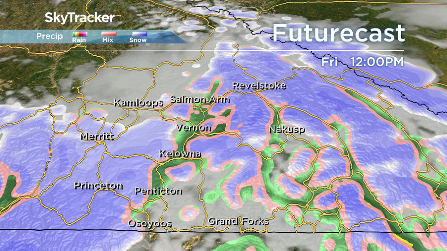
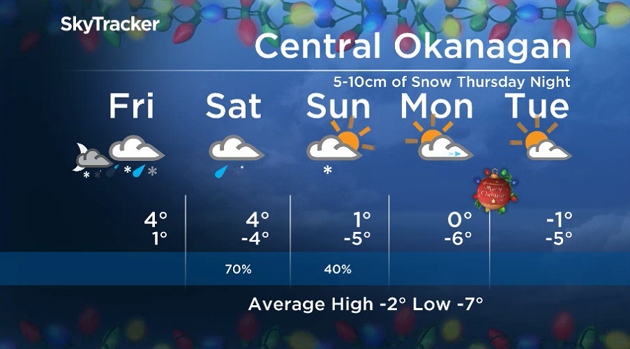
The main brunt of the snow will fall Thursday night into Friday morning, before rising freezing levels allows rain to mix in during the day on Friday.
Rain and snow will continue into the day on Saturday, as temperatures in the valley bottom rise to around 4 degrees for the second day in a row.


Cooler air starts to swing in on Sunday, with sunshine to start followed by clouds and a chance of evening flurries before sub-freezing daytime highs roll in heading into Christmas week.
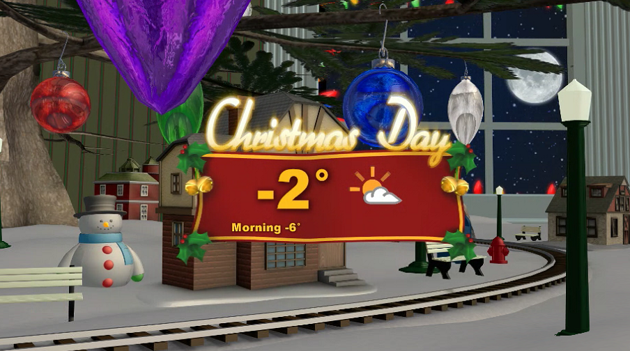
Morning valley cloud and afternoon sunny breaks will return from Christmas Eve through Boxing Day, with daytime highs around -2 degrees for Christmas.
For weather on the go download the Global News SkyTracker Weather App for iPhone, iPad or Android.
Comments
Want to discuss? Please read our Commenting Policy first.