

In British Columba, slides are part of the provincial landscape.

And no, we’re not talking waterslides, like the ones at Cultus Lake near Chilliwack, but rather road-burying, chaos-causing slides.
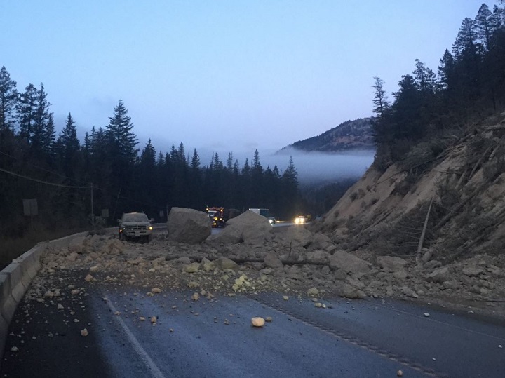
Earlier this month, debris from a slide smothered a section of Highway 93 just south of Fairmont Hot Springs, stopping traffic for several hours until it was cleared.
Other recent examples include the rock slide in the Fraser River that was discovered in June near Big Bar, and the rock slide last February that buried Highway 97 near Summerland, effectively cutting the Okanagan in half for weeks.
A geology professor from Simon Fraser University, Brent Ward, talked with Global News about those slides, and other topics.
Global News: Are slides increasing in frequency? Or is the number consistent but the media is reporting on them more often?
Brent Ward: “Landslides are happening all the time. I think we notice them when they actually affect infrastructure, such as a major highway.
“But landslides are (also) affecting remote areas — say, logging roads, other resource roads — all the time. We don’t have any data to prove that landslides are increasing yet, but it could be happening.”

GN: If there is an increase, is it weather-related?

Get breaking National news
BW: “Certainly most of the landslides we deal with are weather-related. Most of the landslides have to do with intense rainstorm events or rain on snow events, or possibly intense thunderstorms or snowmelt.
“But to track that in terms of climate change, it’s really hard to do. But what we do see is an increase in forest fire frequency. Certainly associated with that, we get an increase in post-fire landslides.
“That could be what you’re seeing in your reporting.”

GN: Is it possible to predict a slide?
BW: “Some slides we probably can predict. If we have an area that we’ve identified as being problematic, that slope can be monitored.
“We can track the rate of movement, and if we start to see an increase in that rate – there’s usually minor movements before – then we can get an idea of when it may happen.
“But a lot of times, you know what British Columbia is like — there’s all kinds of steep slopes and rock and sediment all over, and it’s very hard to know which areas may or may not fail. And it just costs a lot of money to monitor those slopes.”

GN: The 2014 Oso slide in Washingon state. Is there a chance something like that could happen in B.C.?
“Certainly we could get very large slides in B.C. that could affect different communities. We have had that in the past in the Nelson-Castlegar area that killed four people. So there are communities that may be at risk.
“The problem is it’s very hard to identify those risks before because so many communities are in these beautiful, picturesque valleys with steep, mountainous slopes around them.”


Comments
Want to discuss? Please read our Commenting Policy first.