

Just as weekend travelers take to the highways, a special weather statement has been issued by Environment Canada for several regions and major highways, including the Coquihalla, the Okanagan Connector, the Hope-Princeton and Highway 97 between Clinton and 100 Mile House.

A frontal system will move across Southern B.C. starting Friday night through Saturday morning.
With cold air entrenched across the Interior, the precipitation will likely be snow. However, there is also a risk that some areas will see freezing rain.
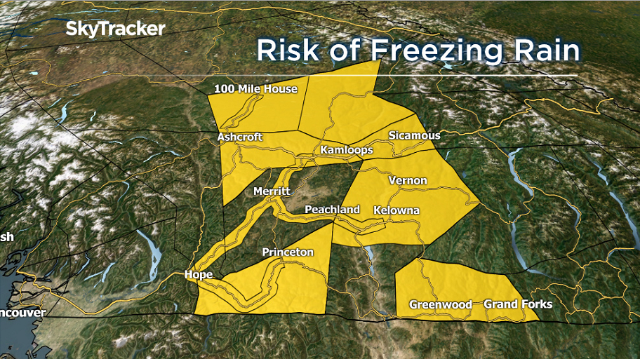
Residents in the following regions should also be aware that sidewalks, parking lots and streets could become very icy.
- North Thompson
- South Thompson
- Similkameen
- North Okanagan, including Vernon
- Central Okanagan, including Kelowna
- Shuswap
- Boundary
- 100 Mile House
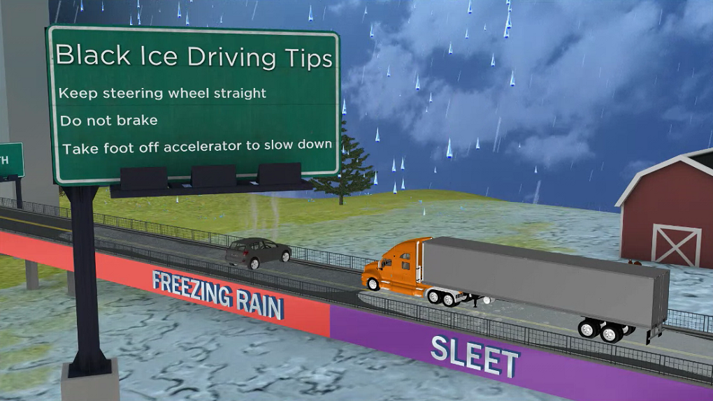


Motorists should have winters tires and be prepared with a cold-weather emergency kit in their vehicle.
If you run into slippery conditions, keep your steering wheel straight and take your foot off the accelerator. Do not brake.
The conditions will improve on Saturday afternoon as temperatures warm up.
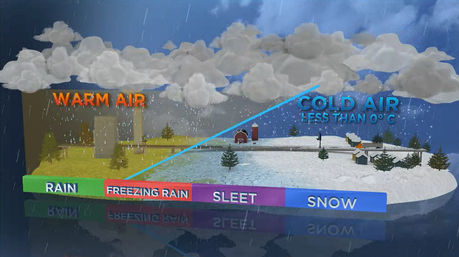
Freezing rain occurs when a warm, wet airmass moves over a cold airmass. The rain ends up falling through an area of cold right near the surface and the rain freezes on impact.
Send your weather photos to weatherwindow@globaltv.com or on twitter to @KGordonGlobalBC
- Joffre Lakes to close for 3 periods this year under agreement with First Nations
- ‘Why aren’t we doing more?’ White Rock on edge with killer on the loose
- B.C. carjacking victim says she doesn’t trust the ‘catch-and-release’ system
- Inquest into fatal Surrey hostage-taking recommends cameras for ERT teams
Comments