

The scope of the damage from the historic California wildfires might not yet be known, but stunning views from space show just how widespread the blanket of smoke is stretching.

Satellite images released by the National Oceanic and Atmospheric Administration (NOAA) show a long plume of smoke drifting from the Kincade fire in Sonoma County across the Pacific Ocean.
The NOAA-20 satellite tracked the smoke plume on Sunday, four days after the devastating blaze first began in the northern California region.
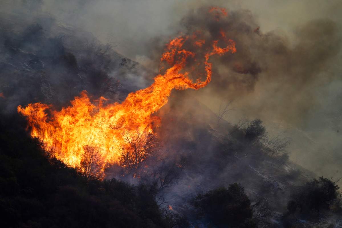
As of Monday, the rapidly expanding fire had grown to 220 square kilometres (85 square miles) and destroyed nearly 100 buildings and was threatening 80,000 more, according to state fire authorities.
It is only five per cent contained.
NASA’s Terra satellite captured a similar image just days earlier. The map pinpoints the fire in the scenic wine country and shows a large swath of land and water covered in a haze of smoke.
“The wind and low humidity have contributed to the swift movement of the fire in such a short amount of time, growing to 10,000 acres in a matter of hours,” NASA wrote in a statement on its website.
While no official cause has been determined, local utility company Pacific Gas and Electric has said that a live transmission line near Geyserville malfunctioned shortly before the fire erupted.

As of Monday morning, more than a million homes and businesses were without power, most from planned outages.
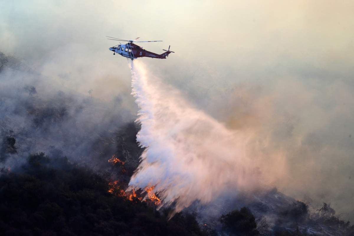
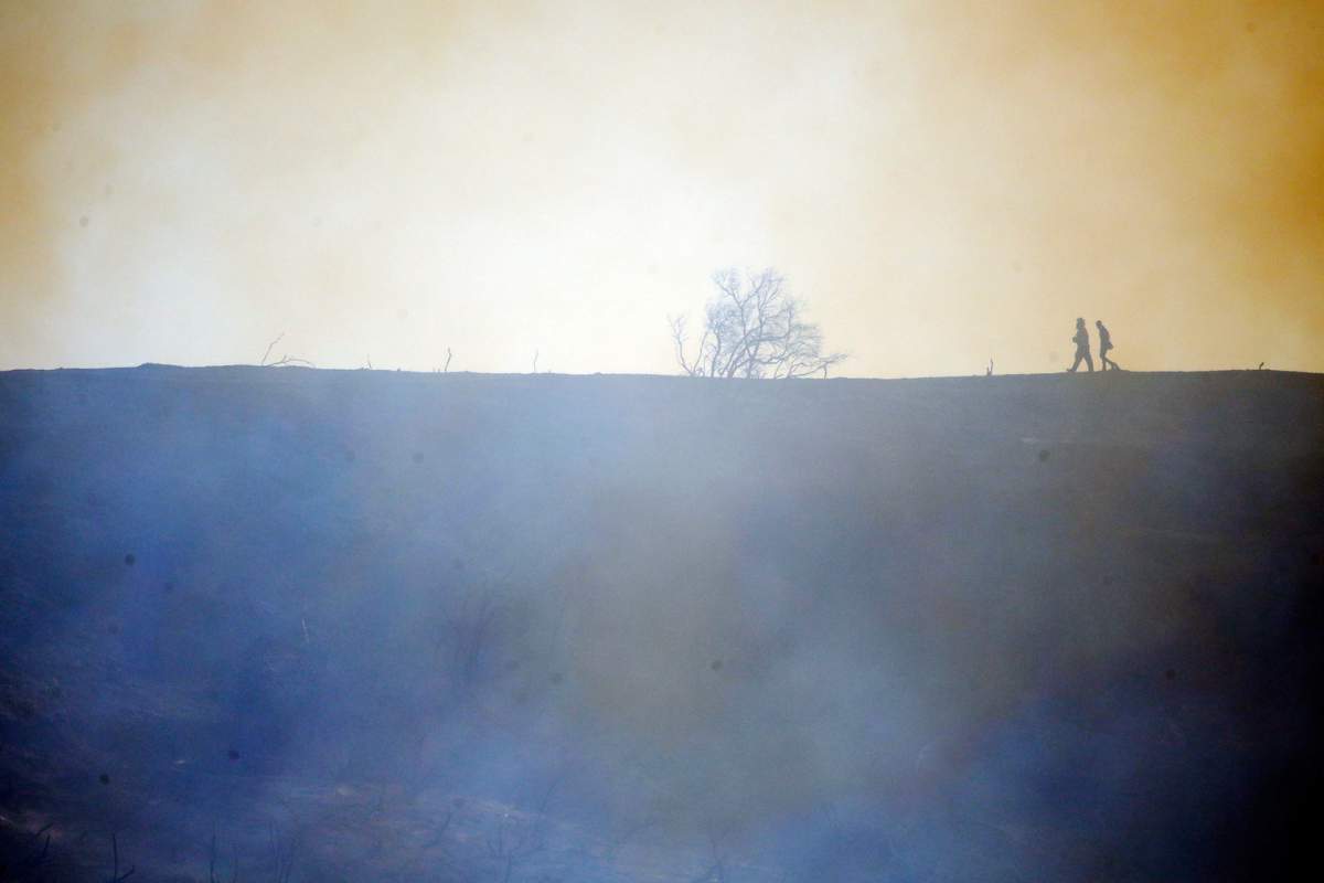
Authorities have described the blaze as a “wind-driven grass and brush fire” exacerbated by hot, dry weather.
Forecasters with the U.S. National Weather Service’s Prediction Center believe wind gusts will decrease in northern California by midday Monday before picking up in the southern part of the state. They could hit anywhere between 80 and 96 kilometres per hour.
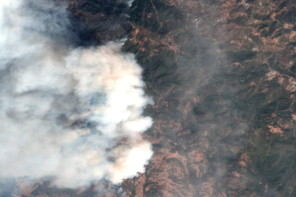
In the satellite image above, taken on Thursday, a plume of smoke towers directly above the fire in Sonoma County. The San Francisco Chronicle reported that the image was taken from 383 miles above land and that the smoke plume stretched approximately 3,000 feet high.
Sonoma is where the biggest evacuation has been ordered, with nearly 200,000 people being told to leave their homes.

Get daily National news
The National Weather Service said “extremely dangerous fire conditions” will continue into Thursday across impacted regions.


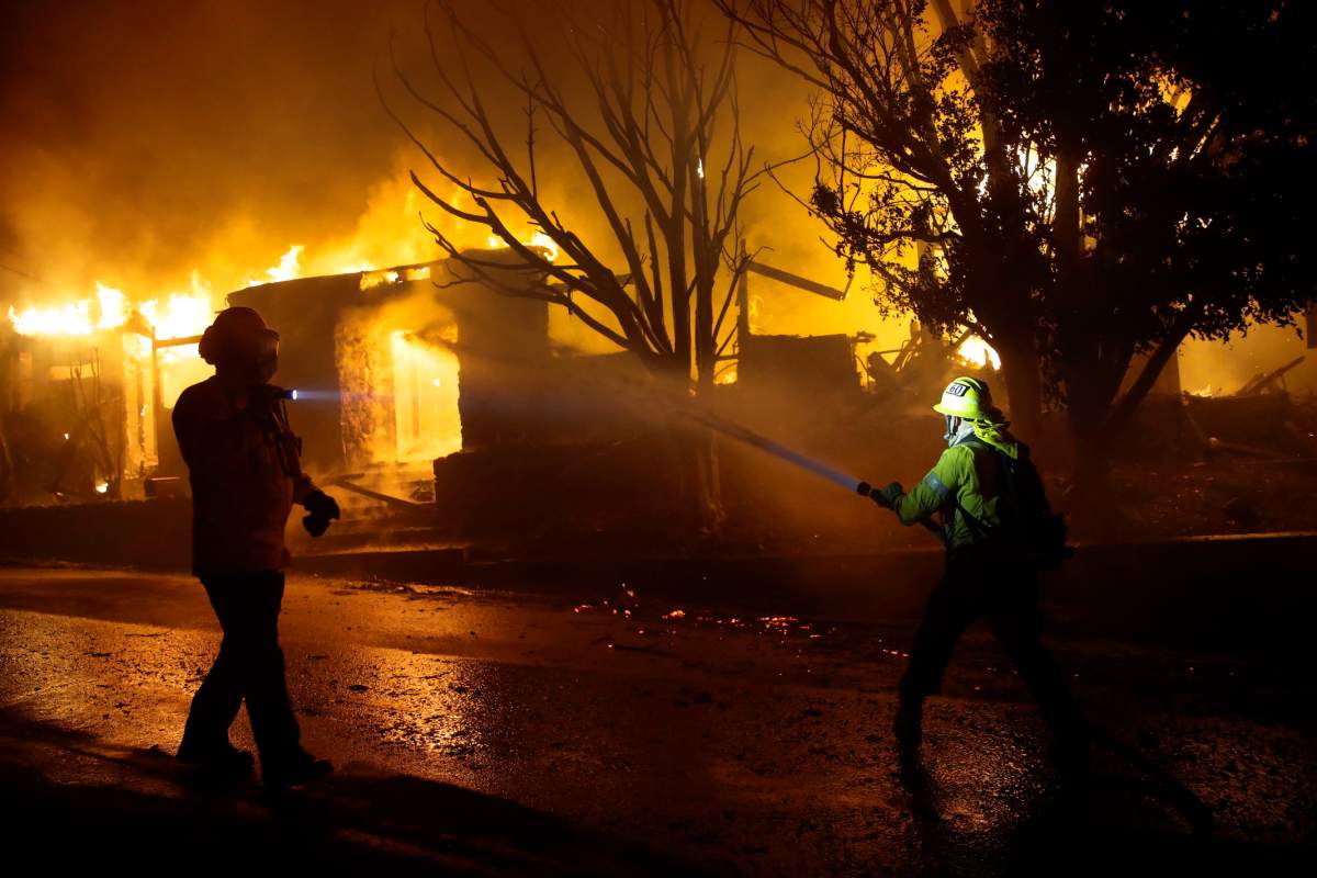
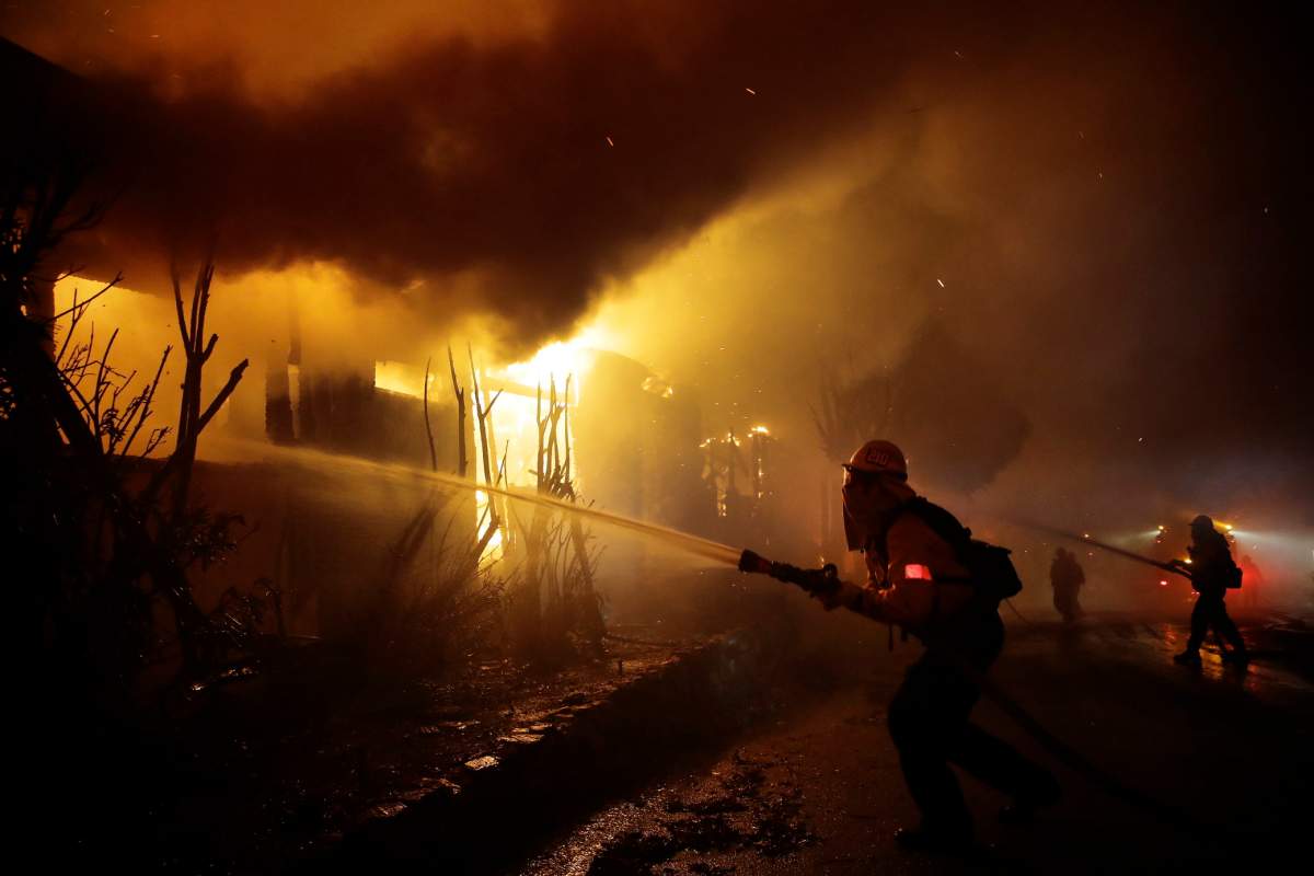
Parts of Los Angeles’ wealthiest neighbourhoods are the latest to be impacted by the wildfire outbreak.
Fires sparked there in the early morning hours on Monday and spread quickly across Interstate 405, consuming hundreds of acres in mere hours. Flames threatened the Getty Center Museum, and more than 10,000 buildings have been placed under mandatory evacuation orders.
At least five homes had burned down, however there were no injuries reported.
— With files from the Associated Press and Reuters
Comments
Want to discuss? Please read our Commenting Policy first.