TORONTO – Cyclist enthusiasts rejoice – Google has added bike directions to six additional European countries due to the success of the feature among cyclists.

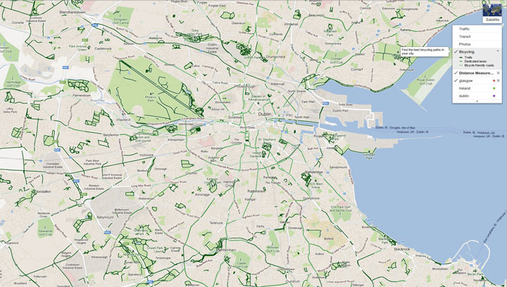
Google has now enabled the bike path feature, which allows users to plot a route that uses bike paths and even avoids busy streets, in Germany, France, Poland, Ireland, Luxembourg and Liechtenstein.
Just like Google’s traditional car or transit maps, bike maps return a series of routes that incorporate bike paths and suitable bike lanes to map a user’s route. Time estimates are even provided by accounting for the type of road, terrain and turns over the course of a ride.
Google uses a colour-coded system to show what bike routes may include.
Dark green lines indicate a dedicated bike-only trail, light green indicate a dedicated bike lane along a road, and dotted green indicate roads that do not have bike lanes but should be suitable for biking.
The feature allows for step-by-step navigation when used on a smartphone with the Google Maps app.

Get daily National news
Google bike maps also allows bike-savvy tourists to take advantage of alternate routes, ranging in difficulty, in order to see popular sites and even bike the same routes as professionals.
“As the season of big bike races in Europe has started, why not check what route Google suggests for a historical stage of the Tour de France? Our bicycle route for the classic stage from Biarritz to Bordeaux navigates on 206 beautiful, often car-free kilometers close to the Atlantic Ocean, compared to the rather boring 206 kilometers on the N10/A63 which is suggested for cars,” read a post on the Google Europe blog.
Google added biking directions for Google Map users in the U.S. and select regions in Canada including Ottawa, Toronto, Edmonton, Kelowna, Vancouver, Calgary, Winnipeg, Gatineau and Waterloo in 2010.
Cyclists in Toronto can take advantage of Google maps bike routes this month, as Toronto’s Bike Month 2013 kicks off.


Comments