
It was a damp end to summer on Sunday with 3.2 millimetres of rain recorded at the Kelowna Airport and that trend continued into the first day of fall on Monday.

The new season officially kicked off at 12:50 a.m. PDT and after temperatures fell to 10 degrees, the mercury slowly climbed into the mid-teens during the day as spotty showers lingered.
Showers start to clear out along with the clouds Monday night with the mercury sliding into single digits overnight.

Get daily National news
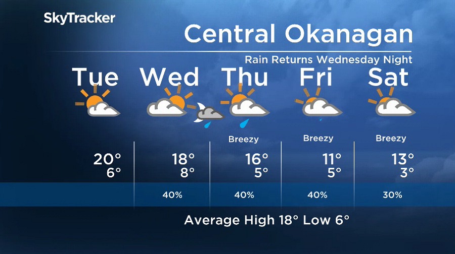
A mix of sun and cloud is on tap for the day on Tuesday with a few pockets of rain possible in the Shuswap and North Okanagan as temperatures make a break for the 20 degree mark in the afternoon.
Sunshine returns to start the day on Wednesday before the next round of fronts pushes back the clouds during the day as the valley warms into the high teens before rain arrives late in the evening.
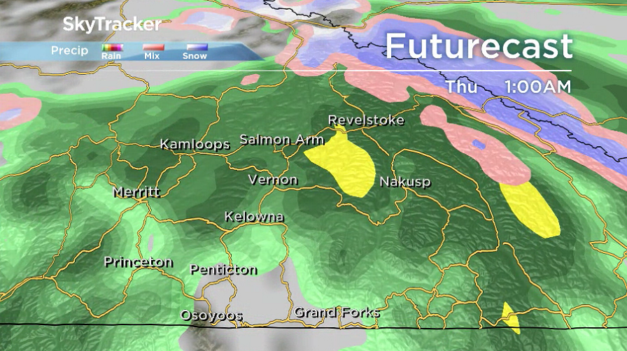


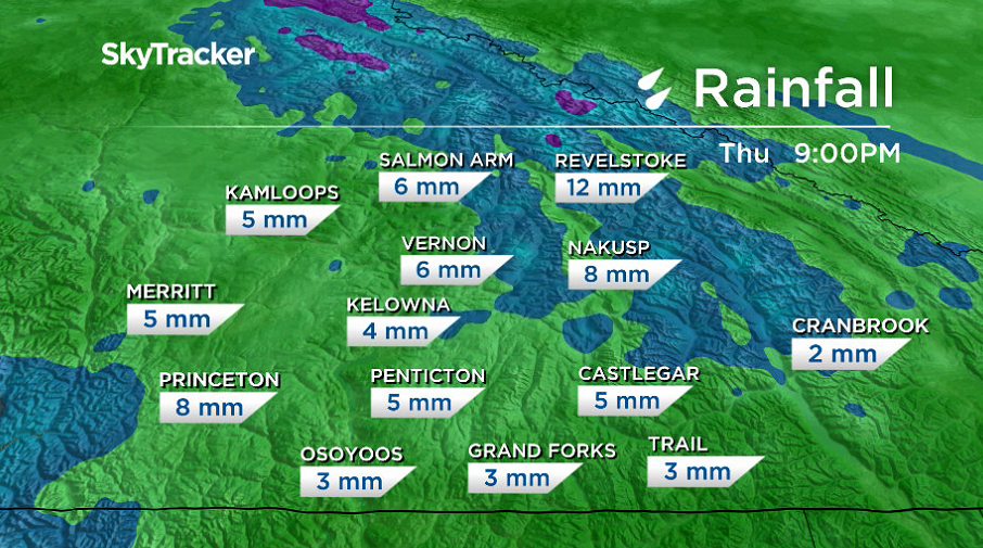
Rain will continue into the early morning hours on Thursday with the chance of showers lingering into the middle of the day before clearing out along with the clouds as temperatures climb into the mid-teens.
Another round of rain arrives on Friday with an upper level low pressure system that could keep some showers around into Saturday as afternoon highs fall into low double digits.
Break from the wet weather is on the way for Sunday with a return to some sunshine, but afternoon highs will stay in the low teens.
For weather on the go download the Global News SkyTracker Weather App for iPhone, iPad or Android.
Comments
Want to discuss? Please read our Commenting Policy first.