

Record cold gets replaced by 30 degree heat.

Weather forecast
Monday
It was a record-breaking Monday morning in Regina, Moose Jaw, Wynyard and Watrous, among other areas, with the mercury dipping back to around 4 C making it the coldest July 29th ever recorded.
After the chilly start to the day, mostly sunny skies helped warm Saskatoon and Regina into the upper teens ahead of the noon hour before soaring further into the mid-20s in the afternoon in the sun.

Get breaking National news
Monday night
Mostly clear skies continue in Regina on Monday evening as cloud and a chance of showers slide into Saskatoon as temperatures fall into low double digits overnight.
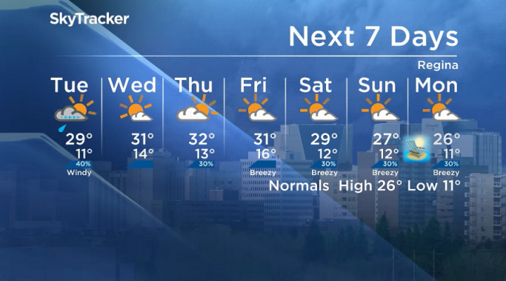
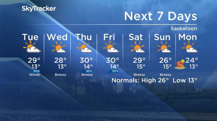
Tuesday
Clouds with a slight chance of showers linger in Saskatoon on Tuesday morning before some midday clearing with a sunny start to the day in Regina and a chance of a late-day shower or storm.
Daytime highs in both cities will make their way into the upper 20s with humidex values into the low 30s as a breezy southeasterly wind gusts upwards of 50 km/h at times.

Wednesday-Friday
Sunshine returns to the region on Wednesday before clouds and the risk of a late-day shower or storm arrives Wednesday and Thursday.
Daytime highs surge back into the low 30s to finish July and start August as an upper ridge of high pressure builds back in.


August long weekend outlook
August long weekend is shaping up to start off hot with afternoon highs around 30 C before they fall back into the mid-20s through the weekend under partly-to-mostly sunny skies with a chance of an isolated shower or storm.
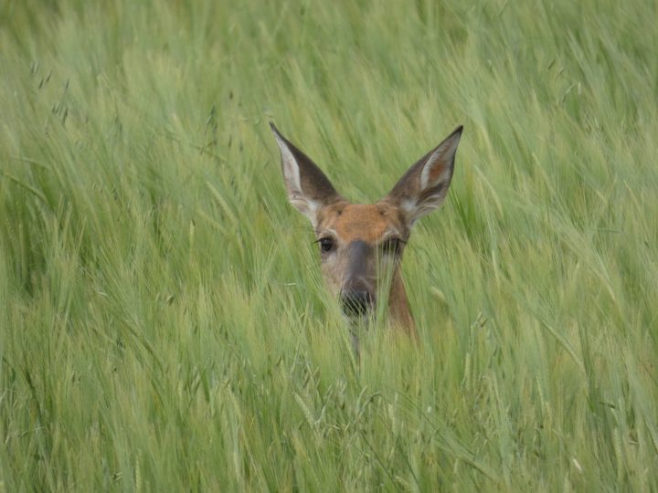
The Your Saskatchewan photo for July 29 was taken by Alie Neish near Naicam:
The Saskatchewan weather outlook is your source for the province’s most accurate forecast and is your one-stop shop for all things weather with comprehensive, in-depth analysis that you can only find here.
Comments
Want to discuss? Please read our Commenting Policy first.