

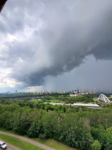
Friday afternoon in parts of central Alberta saw a mixed bag of extreme weather, including a brief tornado warning and severe thunderstorm warnings and watches.

By 6:30 p.m., all of the severe warnings had been dropped. By 9 p.m., the remaining thunderstorm watches for central Alberta, including the city of Edmonton, were also dropped. At that time, all that remained were two thunderstorm watches for northwestern Alberta (Grande Prairie, Peace River area).
A severe thunderstorm warning south of Edmonton was updated to a tornado warning for a short time Friday afternoon.
At around 4:30 p.m., Environment Canada issued a tornado warning for Leduc County in the area of Calmar and Devon. The tornado warning was switched back to a severe thunderstorm warning at around 4:45 p.m. That warning was later downgraded.
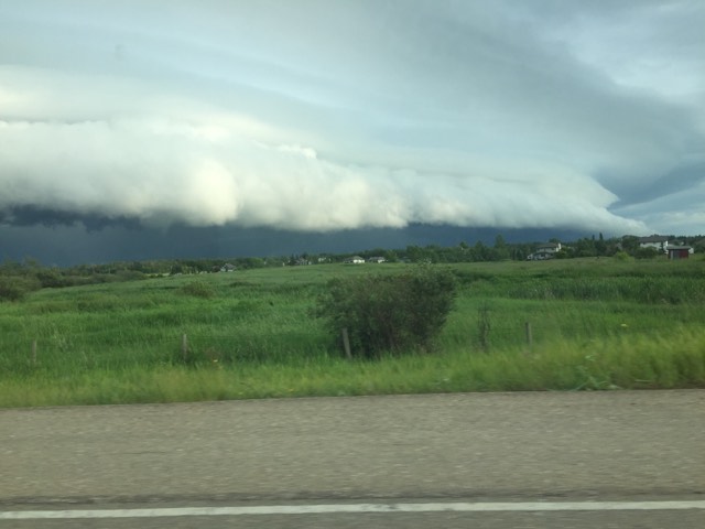
Shortly before 5:30 p.m., another severe thunderstorm warning was put in place for the areas around Spruce Grove, Morinville, Mayerthorpe, Evansburg, Whitecourt, Edson, Fox Creek and Swan Hills. Lloydminster, Wainwright, Vermilion and Provost were also put under a severe thunderstorm warning just before 6 p.m. They were all later downgraded.

Get daily National news
A full list of areas under the advisories is available here.


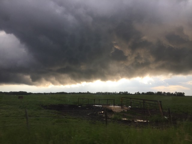


“Environment Canada meteorologists are tracking a severe thunderstorm that is possibly producing a tornado,” the weather agency warned of the storm that could have produced the tornado. “Damaging winds, large hail and locally intense rainfall are also possible.”
At the time of the tornado warning, the storm was about 10 kilometres east of the town of Thorsby and was moving to the west at 25 km/h.
Watch below: Meteorologist Jesse Beyer is providing a severe weather forecast from K-Days on Friday, July 19, 2019.

- Sawmill closures ‘gut-wrenching’ amid lumber industry headwinds: Canfor CEO
- Global burning at record low, despite North American and European wildfires
- Judicial review request challenges denial of Corb Lund’s ‘Water Not Coal’ petition
- France lets 84K evacuees go home as wildfires spread across Europe


That warning fell in the midst of a busy afternoon of watches and warnings in central Alberta.
At around 3:30 p.m., Environment Canda lifted a severe thunderstorm warning for the capital, but issued a new one for the areas of Drayton Valley, Devon, Rimbey and Pigeon Lake east of the city and Leduc, Camrose, Wetaskiwin and Tofield south and southwest of the city.
The storm cell was expected to be capable of producing strong wind and nickel- to ping pong ball-sized hail, the weather agency said.
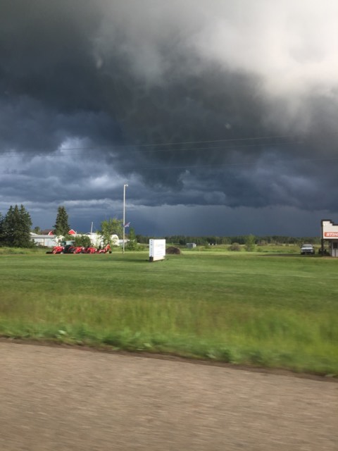
The area of Whitecourt, Edson, Fox Creek and Swan Hills as well as the Slave Lake area were also put under a thunderstorm warning at that time.
“Severe thunderstorm warnings are issued when imminent or occurring thunderstorms are likely to produce or are producing one or more of the following: large hail, damaging winds, torrential rainfall,” Environment Canada said on its website.
The initial warning was issued at 2:10 p.m. when the weather agency said its meteorologists were tracking the storm cell. At that time, it was located north of Edmonton and was moving south east at 20 km/h.
Want your weather on the go? Download Global News’ Skytracker weather app for iPhone, iPad and Android.
Comments
Want to discuss? Please read our Commenting Policy first.