
Daytime highs sat in the mid-20s with some scattered showers over the first weekend of summer before temperatures dipped down to 12 degrees to start the final week of June.

Some midday sunny breaks were soon smothered by cumulus clouds building up on the ridgetops, bringing in a chance of afternoon showers as the mercury makes it into the low 20s.
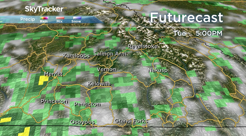
Sunshine slides in to start the day on Tuesday with temperatures sneaking into single digits before a churning system off the coast kicks clouds back in during the day with a chance of late day showers.

Get daily National news
The mercury should make it a few degrees further during the day, up to around 24 degrees Tuesday afternoon.


Yet another round of showers are possible Wednesday afternoon after a sunny start to the day with almost a carbon copy of temperatures, making it up to the mid-20s for a daytime high.
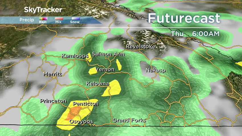
The system then swings into the Interior on Thursday, bringing in mostly cloudy skies with an even better chance of rain and risk of a thunderstorm, suppressing afternoon highs back into the low 20s.
The effect of that system will keep clouds and showers around Friday and Saturday with afternoon temperatures in the low 20s before sunshine returns Sunday and Canada Day Monday with daytime highs back into the mid-20s to finish the long weekend.

For weather on the go download the Global News SkyTracker Weather App for iPhone, iPad or Android.


Comments