

Environment Canada has issued a special weather statement for the Coquihalla Highway, Okanagan Connector, Rogers Pass, Allison Pass and Paulson Summit to Kootenay Pass for late-season snow Friday morning.

The culprit is a cold, upper trough moving through British Columbia, giving late season flurries Thursday night into Friday morning.
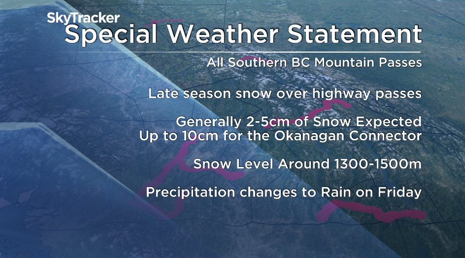
Flurries are expected above 1,300 to 1,500 metres in elevation, though they could briefly descend to lower elevations during periods of intense flurry activity.
Most southern highway passes are forecast to receive 2 to 5 centimetres of wet snow overnight through Friday morning, with up to 10 cm possible on the Okanagan Connector.
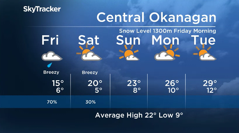
Precipitation will change back to rain on Friday, as the air mass begins to warm.

Get daily National news
Coming off a mild week with daytime highs holding steady in the mid 20s in the valley bottom, a few showers and much cooler temperatures will work their way into the forecast to finish the first week of June.
A few showers Wednesday night eased by Thursday morning, as temperatures slid back to 10 degrees as mostly cloudy conditions continue into the afternoon with a daytime high hoping to hop into the 20s.


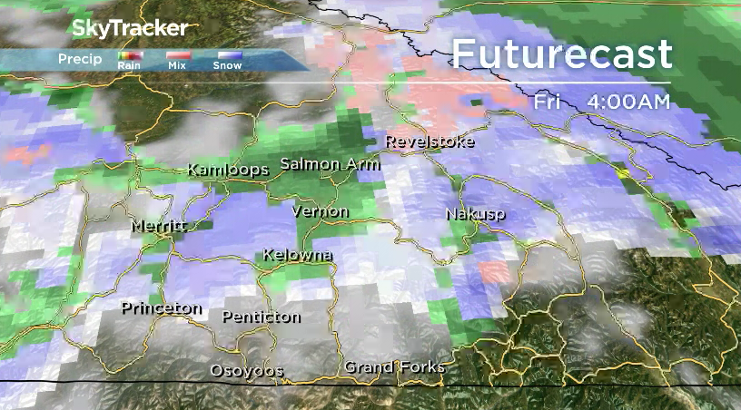
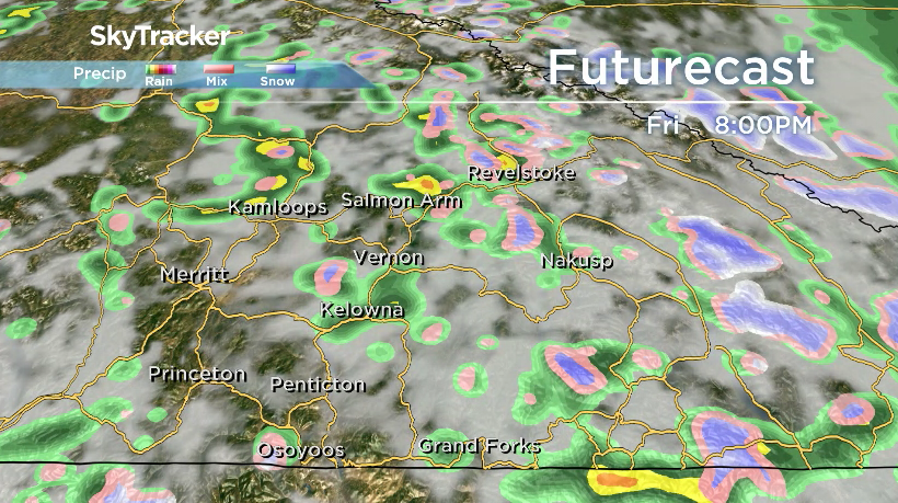
Partly-to-mostly cloudy conditions will move in Thursday night, with a chance of showers arriving Friday morning with a cold upper low that will drop freezing levels to 1,300 metres in the morning before rising back to 1,800 metres in the afternoon.
Snow is possible, with accumulations possible along high elevation travel routes as showers and the risk of a thunderstorm sweep through the valley bottom, with up to 10 millimetres of rain possible in pockets.
After a cooler day on Friday, with afternoon highs back into the mid-teens, the mercury will return to the low 20s on Saturday with a chance of showers in the morning and some clearing later in the day.
Mostly sunny skies and dry conditions return on Sunday, as daytime highs climb back into the low-to-mid 20s.
The second week of June will also start out on a sunny note Monday morning before high clouds roll back in during the day, as the mercury makes a break for the mid 20s.
Sizzling 30-degree heat returns by the middle of next week, as an upper ridge arrives, bringing back beautiful blue skies and sunshine.
For weather on the go download the Global News SkyTracker Weather App for iPhone, iPad or Android.


Comments