

Snow returns for the final week of March.

Saskatoon forecast
Monday
-13 is what it felt like with wind chill as the final week of March kicked off Monday morning as temperatures slid back to -8 C to start the day.
Partly-to-mostly sunny skies lingered through the morning as the mercury rose to the freezing mark before noon.
Clouds roll in during the afternoon as the region warms to a daytime high around 5 C.

Get daily National news
Monday night
Partly-to-mostly cloudy skies stick around Monday night as conditions cool back below freezing by a few degrees.
Tuesday
-8 is what it’ll feel like with wind chill Tuesday morning as you’re heading out the door with a few clouds to start the day.
Midday sunny breaks are likely before the next batch of clouds builds in with a system moving in from Alberta that’ll help bring back double digits during the afternoon with a chance of showers in the evening hours.

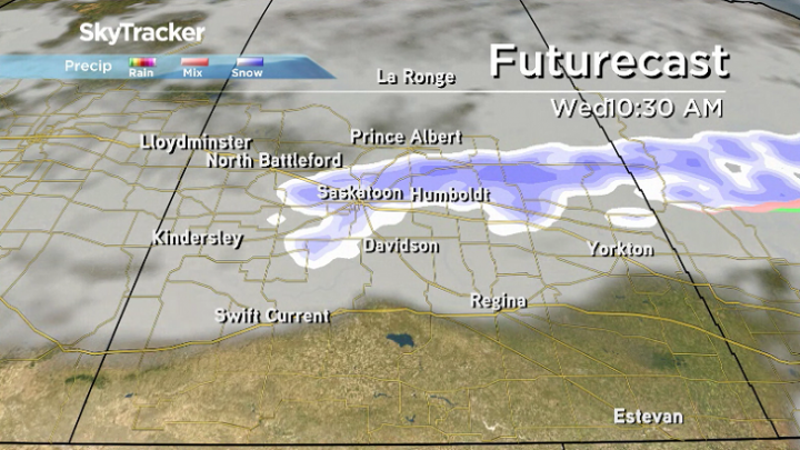
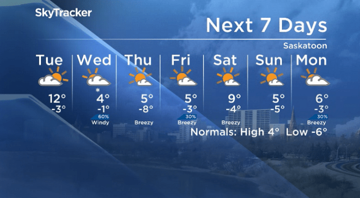
Wednesday-Friday
Snow is possible Wednesday morning with a lingering front behind the system will keep the region in the clouds all day with gusty northwest winds and temperatures only making it up to around +4.
Cooler air lingers for the rest of the week behind the system, keeping daytime highs around 5 C and overnight lows in mid-minus single digits under partly-to-mostly sunny skies.


Weekend outlook
Mostly sunny skies are expected for the final weekend of March with daytime highs getting close to and potentially into double digits on Saturday before falling back into mid-single digits on Sunday.
The Your Saskatchewan photo for March 25 was taken by Brittany Biberdorf in Kenaston:

Saskatoon weather outlook is your source for Saskatoon’s most accurate forecast and is your one-stop shop for all things weather for central and northern Saskatchewan with comprehensive, in-depth analysis that you can only find here.
For weather on the go download the Global News SkyTracker Weather App for iPhone, iPad or Android.
Comments
Want to discuss? Please read our Commenting Policy first.