


After a way warmer than normal first weekend of 2019 with a daytime high on Sunday an impressive 10 degrees above average, relatively cooler and wetter conditions rolled in to start the week.

It was a bit of a rude awakening and return to work and school after an extended holiday break in the North Okanagan with a wave of snow and gusty wind sliding in Monday morning.
That wave also clipped parts of the Central Okanagan as the region caught the tail end of a cold front sliding by, which will knock daytime highs back into low single digits Monday afternoon as snow eases.

Get breaking National news
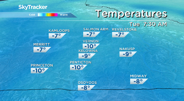
Skies then clear through the evening and temperatures plunge toward minus double digits as an arctic high pressure system drops in overnight.
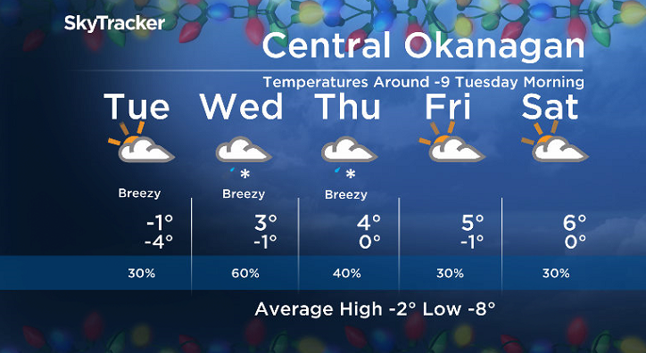
Minus 9 is around where the mercury will bottom out by Tuesday morning with some sunshine possible early in the day before clouds swing back in with a slight chance of late day flurries.


The region will stay below freezing all day with afternoon highs aiming to hop up to -1 before sundown.
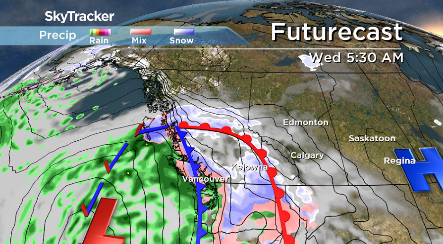
The chance of snow increases Tuesday night into Wednesday morning as moisture from a system off the coast streams into the BC Interior, which could bring a risk of late day rain as temperatures warm a few degrees above freezing for an afternoon high.
A chance of precipitation returns, but to a lesser extent on Thursday under mostly cloudy skies with an afternoon high making it back into mid-single digits.
Further warming is anticipated heading into the second weekend of the year with afternoon highs Friday through Sunday edging into the 5 to 6 degree range under partly-to-mostly cloudy skies.
For weather on the go download the Global News SkyTracker Weather App for iPhone, iPad or Android.


Comments
Want to discuss? Please read our Commenting Policy first.