
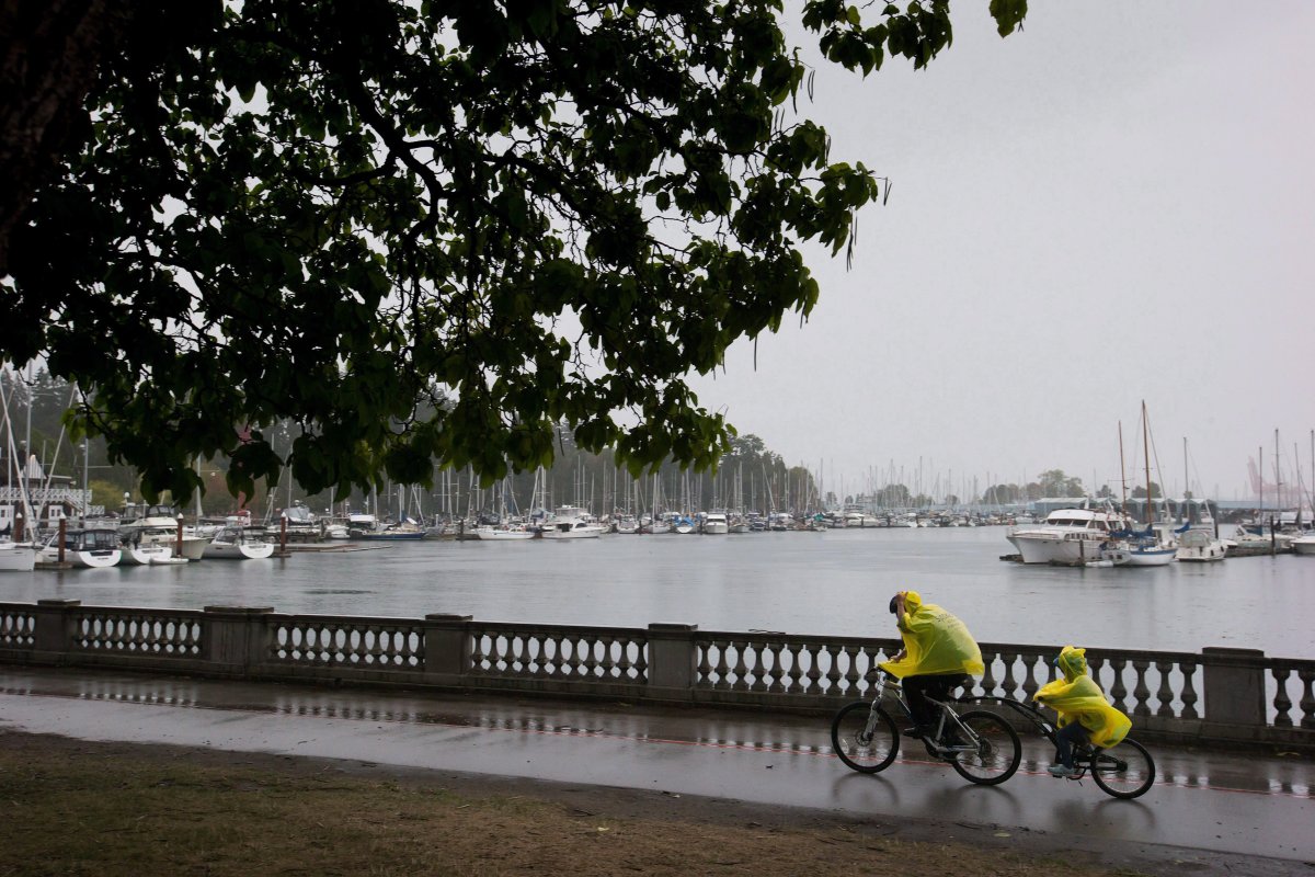
The first big Pacific storm of the season hit the South Coast on Thursday night.

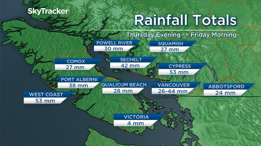
Some regions saw over 50 millimetres of rain.
That tapered off by the morning, but it was just the first part of the storm and more is on the way.
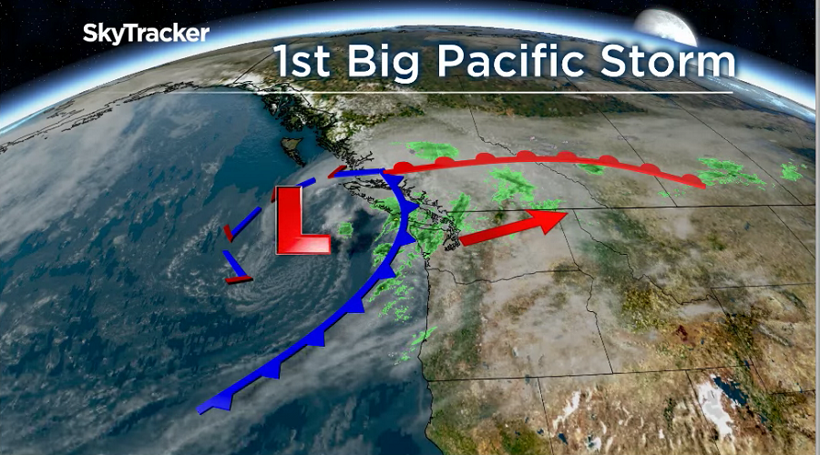
The second wave of this system, the cold front, is about to hit and this will be stronger than the first wave.
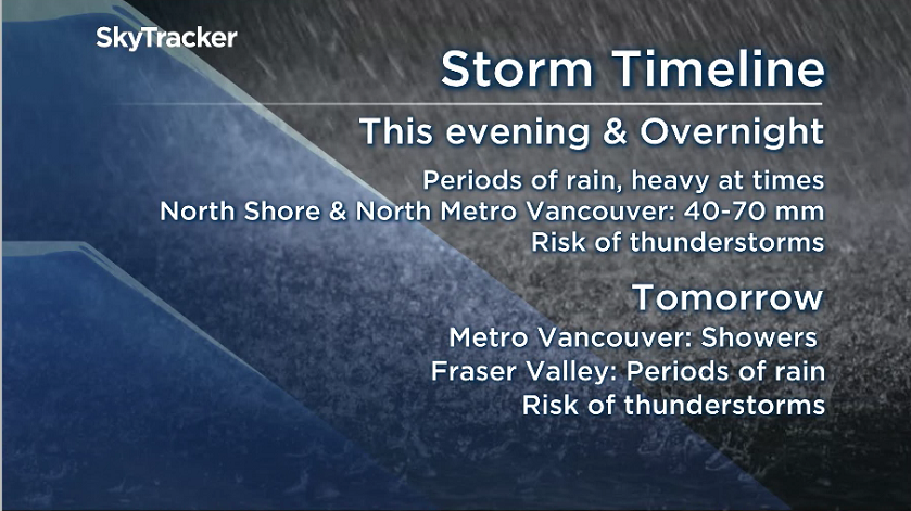
We will see periods of heavy rain at times this evening and overnight.

Get daily National news
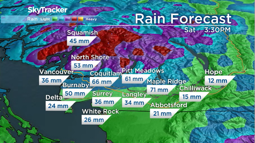
The hardest hit areas will be from Burnaby across to Maple Ridge and then north to the mountains where 40 to 70 millimetres is possible by Saturday morning.
Localized flooding is a concern, and drivers are being reminded to slow down on the roads.
Areas further south will see far less rain.
Areas such as Delta, Surrey and east towards Abbotsford can expect to see 20 to 40 millimetres of precipitation.


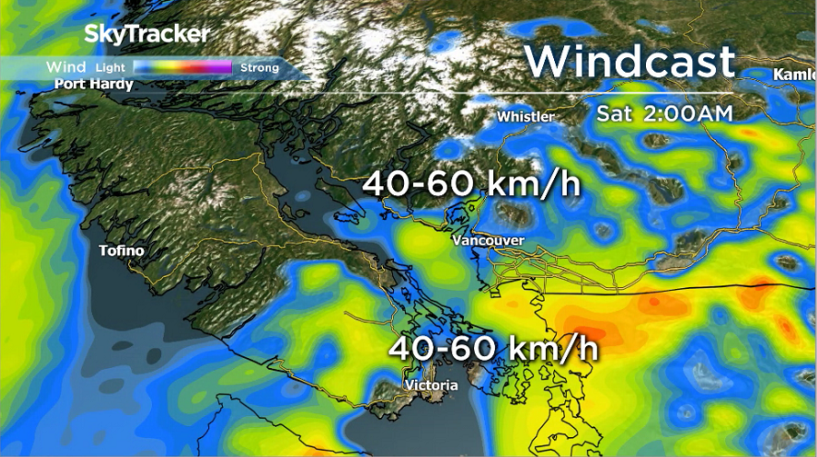
Wind will also be factor overnight and through the morning on Saturday.
The south coast could see wind gusts up to 60 kilometres per hour.
Tree branches may break and power outages are possible.
Saturday morning conditions will ease off to showers, or spotty rain.
However, there is also the risk of isolated thunderstorms which could roll through briefly, bringing heavy rain, hail and lightning.


Comments