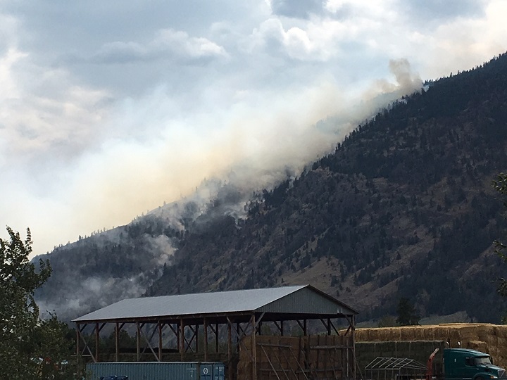
A state of local emergency has been declared near Cawston, B.C., because of the Snowy Mountain wildfire.

Estimated on Thursday at 6,594 hectares, that number is expected to increase. According to the B.C. Wildfire Service, overnight and early morning winds have fanned the out-of-control fire. As a result, the Regional District of the Okanagan Similkameen issued a state of local emergency, along with an evacuation order for three properties on Chopaka Road in Cawston.
According to the RDOS, “declaring a state of local emergency enables local authorities (Regional Districts, municipalities) in the Province of British Columbia to utilize the emergency powers listed in the Emergency Program Act. The emergency powers are used by the local authority to order the evacuation of residents from their homes, prohibit travel and enter private property when an emergency threatens lives, property or the environment within the local authority’s jurisdiction.”
As to how big the Snowy Mountain fire is, BCWS fire information officer Claire Allen said it’s a shifting number because of weather conditions.

Watch above: Fire Information Officer Claire Allen describes the fight against the Snowy Mountain Fire.
“Our crews are out there today, getting better eyes on the fires, so a new size estimate will be published (later today) once we’re able to determine a more accurate fire perimeter,” said Allen.
“For the last two nights, we’ve been challenged by these unexpected cold fronts that have really kicked up strong, gusty winds in the overnight and early morning periods. Last night, we had winds coming downslope at about 50 km/h, and those are continuing today at about 25 km/h. And given the challenging topography of the fire, the winds aren’t consistent across the whole fire perimeter.

Get breaking National news
“On the north side, we’re seeing some winds coming from the west, which is pushing smoke into Cawston and Keremeos. We’re seeing some low to moderate fire behavior in that area, however, on the south and east flanks, we’re having winds coming from the north, so that is pushing the fire to the south.”
BCWS said there will be planned burns set today to help bring the fire under control “on those steep slopes on our terms.”
“The reason we have to do (the controlled fires) from the valley bottom is that’s just where our operations are achievable and are safe for firefighters,” said Allen. “It’s a lot of steep topography, draws, gulleys, scree slopes. In terms of the fire behavior that we’re seeing and the fuel type of a lot of grass and sagebrush, it’s just not operationally achievable to fight that fire mid-slope, and it’s not going to be safe for our boots on the ground.”
Rain is expected to fall in the Similkameen and Okanagan today and Saturday, though BCWS says it likely won’t be enough to make a difference.
“We’ve seen very little (rain),” said Allen. “Yesterday on one part of the fire, there was enough to rain to wet the pavement that our firefighters were staging off from. But we still saw sustained fire behaviour throughout (Thursday). Nothing to really dampen it.
“The rain development that we’ve been seeing has been fairly spotty. Some areas of the fire might get (rain) and other areas might not. As much as we’d love to have substantial precipitation, we’re not hanging any hopes on that, especially as we look at the long-term forecast. It does look like we’ll be going back to some fairly high temperatures after the weekend.”


Comments