
Mother Nature was not relenting late Wednesday night as a severe thunderstorm warning was issued for Edmonton and the surrounding area after a day of wild weather and intense storms across Alberta that even saw tornado warnings issued in the southern part of the province.

“Persons in or near this area should be on the lookout for adverse weather conditions and take necessary safety precautions,” Environment Canada said in its warning issued at 10:11 pm. “Watch for updated statements.
“Please refer to the latest public forecasts for further details and continue to monitor the situation through your local radio and television stations or Weatheradio.”
Tornado warnings were lifted in southern Alberta on Wednesday night nearly an hour and a half after the first one was issued for Siksika Reserve 146.
Environment Canada issued the tornado warning for Siksika Reserve at 6:54 p.m. The weather agency later also issued a tornado warning for the County of Newell, near Bassano.
Both warnings were lifted at 8:23 p.m.
“In addition to a tornado, this severe thunderstorm is capable of producing golf ball-sized hail and damaging, straight-line winds in excess of 100 kilometres per hour,” the weather agency said on its website shortly before 7:30 p.m.
“This is a dangerous and potentially life-threatening situation. If you hear a roaring sound or see a funnel cloud, swirling debris near the ground, flying debris, or any threatening weather approaching, take shelter immediately.”
An Alberta Emergency Alert said a “rotating thunderstorm” was possibly producing a tornado about 15 kilometres west of Gleichen and was moving southeast at about 40 km/h.
“Seek shelter immediately in a basement or reinforced structure,” the alert said. “Get low and put as many walls between yourself and the storm as possible. Stay away from windows, doors and outside walls. If you are on the highway and cannot avoid the tornado, seek shelter in a ditch or ravine.”
Environment Canada issued the tornado warning for Siksika Reserve at 6:54 p.m.
Meanwhile, the Town of Beaverlodge was hit hard Wednesday afternoon while a swath of northern, central and southern Alberta was under severe thunderstorm watches and warnings.
In northern Alberta, the chief administrative officer for the town said it was hit with over 45 millimetres of rain on Wednesday.
Tin Letendre said that from Highway 43 to the town’s office, the water level has been reported “as high as a door handle on a full-sized pickup truck” in some areas.
Watch below: The RCMP said the Beaverlodge area was hammered with “severe rain and hail” at about 3 p.m., “resulting in immediate and massive flooding in various areas.”

The RCMP said the Beaverlodge area was hammered with “severe rain and hail” at about 3 p.m., “resulting in immediate and massive flooding in various areas” and forcing the closure of an area highway for a time.
“Highway 43 is being diverted at both the east and west end of Beaverlodge,” police said in a news release. “Motorists will be detoured onto Highway 722 to get around Beaverlodge.”

Get daily National news
Mounties were working with fire crews and other agencies to address the situation late Wednesday afternoon; the highway was reopened by the evening.
“Emergency crews are on scene pumping water away from the areas affected.” the Grande Prairie Regional Emergency Partnership said Wednesday night.
“Emergency response crews are also assessing conditions to determine whether further assistance and resources are needed.
“Water levels have receded, but the public are strongly encouraged to avoid the area until further notice,” officials added.
“Water quality is good and will continue to be monitored, however, area residents are encouraged to stock up on drinking water. If you are experiencing an emergency, immediately call 911.”
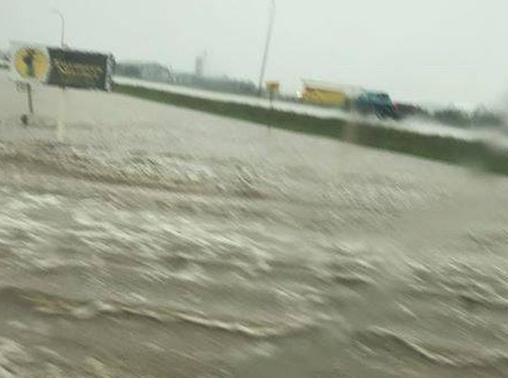
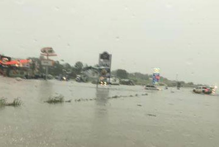
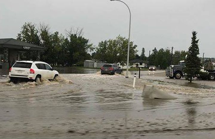
Photos taken by people in the area showed vehicles partially submerged under water.
View photos of the flooding in Beaverlodge on Wednesday in the gallery below:


A second severe thunderstorm warning was issued for Calgary on Wednesday just after 5:30 p.m. by Environment Canada with the potential to produce quarter-sized hail. The agency ended it around 6 p.m.
A previous warning was issued at 3:30 p.m. and was lifted at 4:45 p.m., as a storm near Cochrane was headed towards Calgary.
Watch below: Lightning was spotted in different parts of Calgary on Wednesday night after a day that saw severe weather hit various parts of Alberta.


A watch issued earlier in the day extended from the Grande Prairie region in the north, to south of Calgary. Edmonton was not included in the watch, but areas to the west and south of the city were.
READ MORE: Severe thunderstorm warnings dropped in Alberta
Environment Canada said conditions were favourable for the development of dangerous thunderstorms that may be capable of producing strong wind gusts, damaging hail and heavy rain.
READ MORE: Heat warning ends for Edmonton and surrounding communities
“On the extreme side of the possible parameters, these storms could produce tennis ball-sized hail or greater, wind gusts in the 90-110 km/h range and flash floods,” Global Edmonton meteorologist Jesse Beyer said.
Watch below: Global Edmonton meteorologist Jesse Beyer has the weather forecast for Edmonton and surrounding areas for Wednesday, Aug. 1, 2018.

“If a storm with those parameters hits any populated industrial or residential area, it could be very damaging with blowing debris, large hail, and localized flooding,” Beyer said, adding farmers’ fields will be fair game for hail and wind damage.
The national weather agency said the thunderstorms would track east through the evening, and some of the storms would be severe.
For a complete list of area in Alberta where a weather alert has been issued, click here.
Severe thunderstorm watches are issued when atmospheric conditions are favourable for the development of thunderstorms that could produce one or more of the following: large hail, damaging winds, torrential rainfall.
Very large hail can damage property, break windows, dent vehicles and cause serious injury. Strong wind gusts can toss loose objects, damage weak buildings, break branches off trees and overturn large vehicles. Heavy downpours can cause flash floods and water pooling on roads.
READ MORE: Dryland canola crops struggle in hot and dry southern Alberta conditions
One of the best ways to track locally hazardous driving conditions is from local viewer reports. The #yegtraffic hashtag is often used by Twitter users reporting traffic issues within Edmonton.
If safe to do so, share your weather photos with us via the Global Edmonton Facebook and Twitter accounts. You can also post updates from your community using the hashtags #yegwx and #abstorm.
Want your weather on the go? Download Global News’ Skytracker weather app for iPhone, iPad and Android.
Comments
Want to discuss? Please read our Commenting Policy first.