
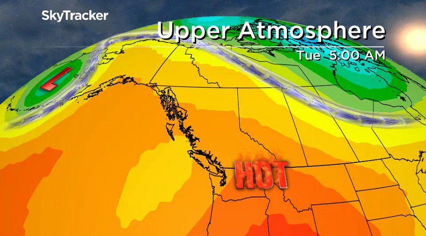
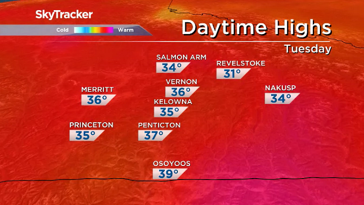
A heat warning kicked off the week in the Okanagan for 35 to 40 degree daytime highs persisting into Tuesday.

The excessive heat is brought on by an upper ridge of high pressure anchored offshore that continues to funnel in the hot temperatures across the region.
Be sure to remain hydrated, spend time in cool spaces, watch for heat-related illnesses and check in on those at a greater risk including the elderly.
The hot air is also coming with lingering smoke with a special air quality statement and smoky skies bulletin still in effect across the Okanagan for wildfire smoke varying in intensity at times.
If you are having difficulty breathing, avoid spending time outside and remain in well-ventilated spaces.

Get breaking National news
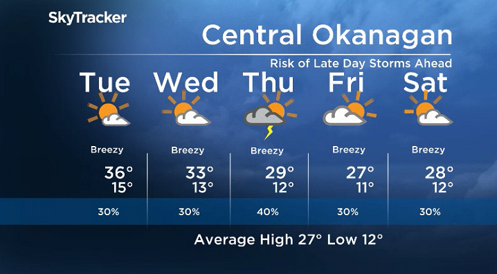
The heat will also come with lots of sunshine, which will stick around on Tuesday before some clouds bubble up in the afternoon with a slight chance of late day showers and the risk of a bit of lightning.
Fire danger rating remains very high to extreme across the valley with bone dry conditions during the day with relative humidity diving back into the teens at times with breezy conditions possible, particularly in the afternoon over the next few days.
After reaching into the mid-30s for an afternoon high on Tuesday, an upper trough will begin to dig in and drop daytime highs back a few degrees on Wednesday toward the low 30s.


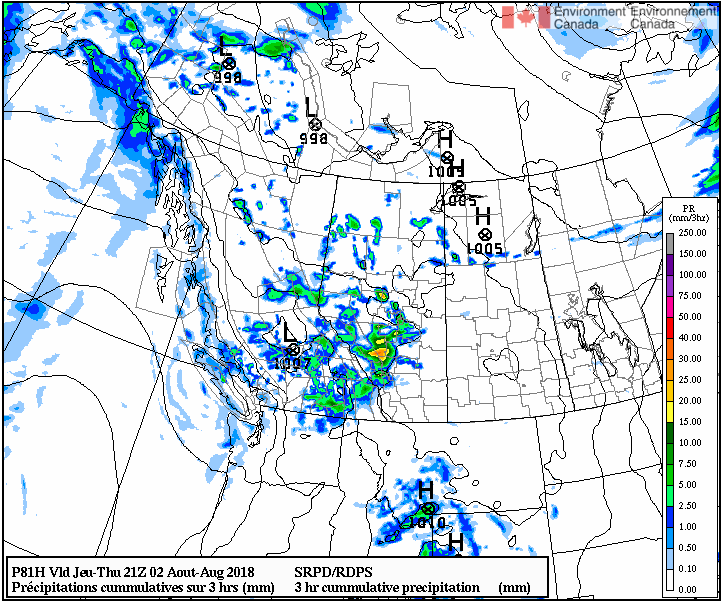
The trough will also open the gate for a better chance of late day storms after a sunny start to the day on Wednesday.
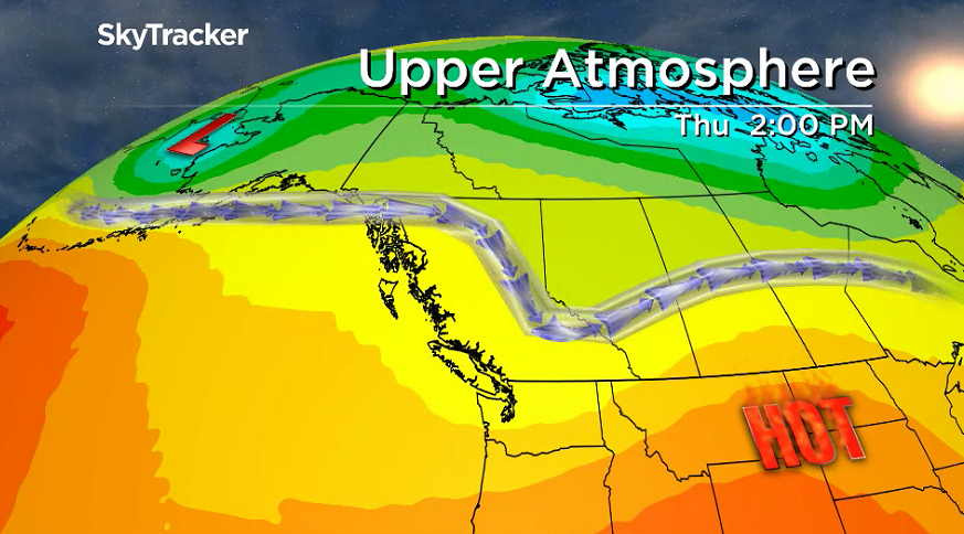
That risk will continue on Thursday as the core of the trough swings through and brings in an even better chance of storms during the day with lightning possible as temperatures dip back into the upper 20s.
There is a good likelihood of lightning and gusty winds with these storms, which will be watched closely as the fire danger remains at very high to extreme across the Okanagan.
The cooler and unsettled conditions will stick around into August long weekend as afternoon highs stay in the upper 20s under a mix of sun and cloud with chance of showers and storms at times.
For weather on the go download the Global News SkyTracker Weather App for iPhone, iPad or Android.


Comments