


Cool, damp ‘Juneuary’ weather across the province might not be ideal for British Columbians hoping to hit the lake, but at least one group is cheering.

The B.C. Wildfire Service is watching the weather closely and says the severity of the summer fire season could depend on how much precipitation the forests soak up this month.
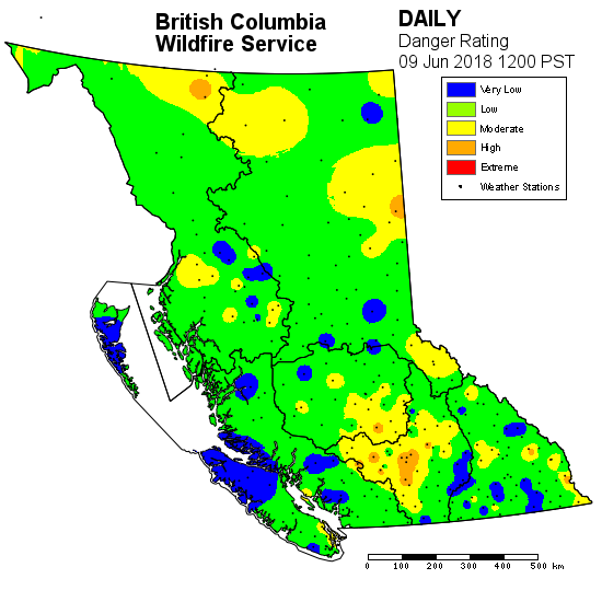
While the month of May set records for lack of rain, fire information officer Claire Allen says with nearly a third of June now under the belt, there are some encouraging signs.
“We’ve had a lot more significant precipitation, especially in areas that happen to be more fire-prone in the central interior,” she said.
Several areas that saw early fire activity this year, including near Lillooet, north of Kamloops, and the northeast, have seen plenty of rain, which Allen said helped crews clear their list of major “fires of note.”

Get breaking National news
Environment Canada has issued a special weather statement for the Okanagan, Shuswap, Boundary, Similkameen and Arrow Lakes this weekend, with rain up to 25 millimetres in some areas.
However, Allen said there are other areas — some of which were hardest hit by wildfires during last summer’s record fire season — that remain concerning.
“Notably the Chilcotin, as well as some areas in the western Kamloops fire centre, and the southeast fire centre, have yet to really see much of the precipitation we’ve had,” she said.


Allen said officials are hoping for recurrent cool, wet weather patterns.
Those allow moisture to seep into leaves and needles, small branches and the flammable “duff” layer of soil just below ground level, which can determine how intense summer fires burn and how difficult they are to put out.
“If we get one significant dump of precipitation and then two weeks after that is a hot stretch of dry weather, that’s not going to be as helpful for us as if we get consistent rainfall over a few weeks,” Allen said.
Despite the cool start to June, Allen said crews remain concerned about the potential for another firey summer, with Environment Canada’s long-range forecast showing July, August and even September with a heightened fire danger risk.
She said the current weather forecasts show plenty of rain in store for the coast and a band of moisture on the way from the south likely to hit the interior, southeast, and Kootenay regions over the weekend.
So far, there have been 260 wildfires recorded in the 2018 season, burning an estimated 36,715 hectares.
Comments
Want to discuss? Please read our Commenting Policy first.