

Strong winds slide back in with a risk of rain.

Saskatoon Forecast
Wednesday
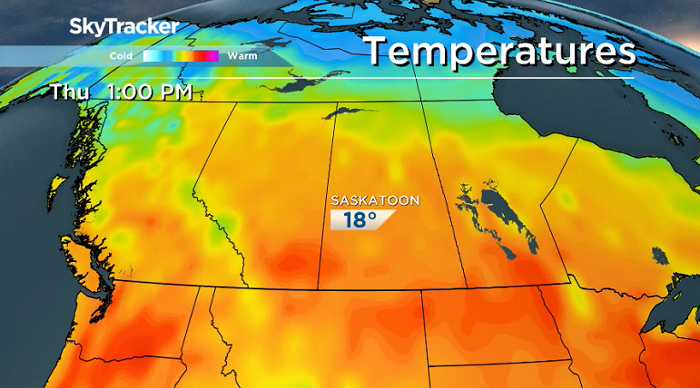
With a bit of rain overnight and mist in the morning, temperatures slid back toward the freezing mark to start the day under mostly sunny skies.
The added moisture last night and warm air rising as the sun started to heat things up helped cumulus clouds to start forming during the day as we made our way up into the low teens before noon.
Partly cloudy skies stuck around for the rest of the day as clouds continued bubbling up and sliding through as we warmed up to an afternoon high in the upper teens.

Get daily National news
Thursday
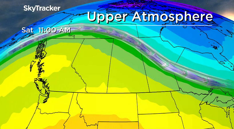
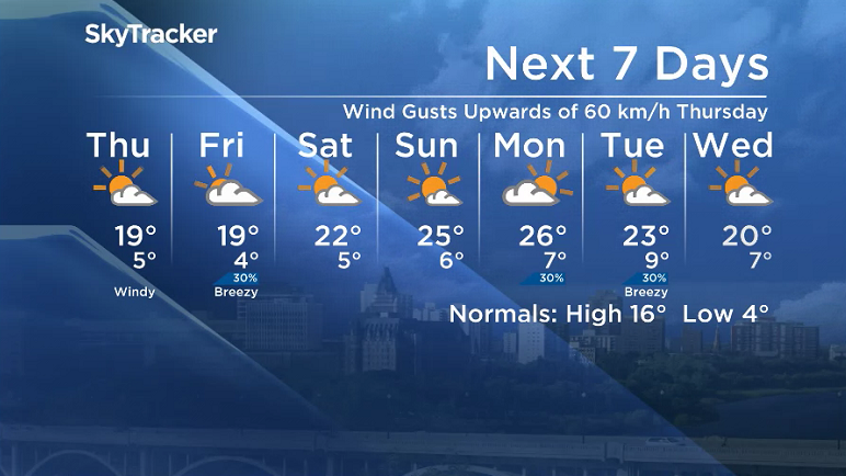
A mix of sun and cloud is on the way for your Thursday along with a strong west-northwesterly wind that will pick up behind a system to 40 km/h with gusts into the 50 to 60 km/h range possible.
Despite the blustery wind, we should still manage to warm up into the upper teens for an afternoon high.


Friday
The work week will finish on a cloudier note on Friday with a low pressure system bringing in a slight chance of showers with mostly cloudy skies sticking around right through the day.
Mild air is expected to accompany this system with the mercury slated to slide all the way up into the high teens in the afternoon.

Weekend Outlook
Heat gets back into full swing this weekend as an upper ridge building back in with some clouds and an afternoon high in the low 20s on Saturday and sunny skies returning Sunday along with mid-20 degree temperatures.
Cranberry Flats was the ideal setting for Ryan Janzen to take the Your Saskatchewan photo for May 2:

Saskatoon weather outlook is your source for Saskatoon’s most accurate forecast and is your one stop shop for all things weather for central and northern Saskatchewan with comprehensive, in depth analysis that you can only find here.
Comments
Want to discuss? Please read our Commenting Policy first.