
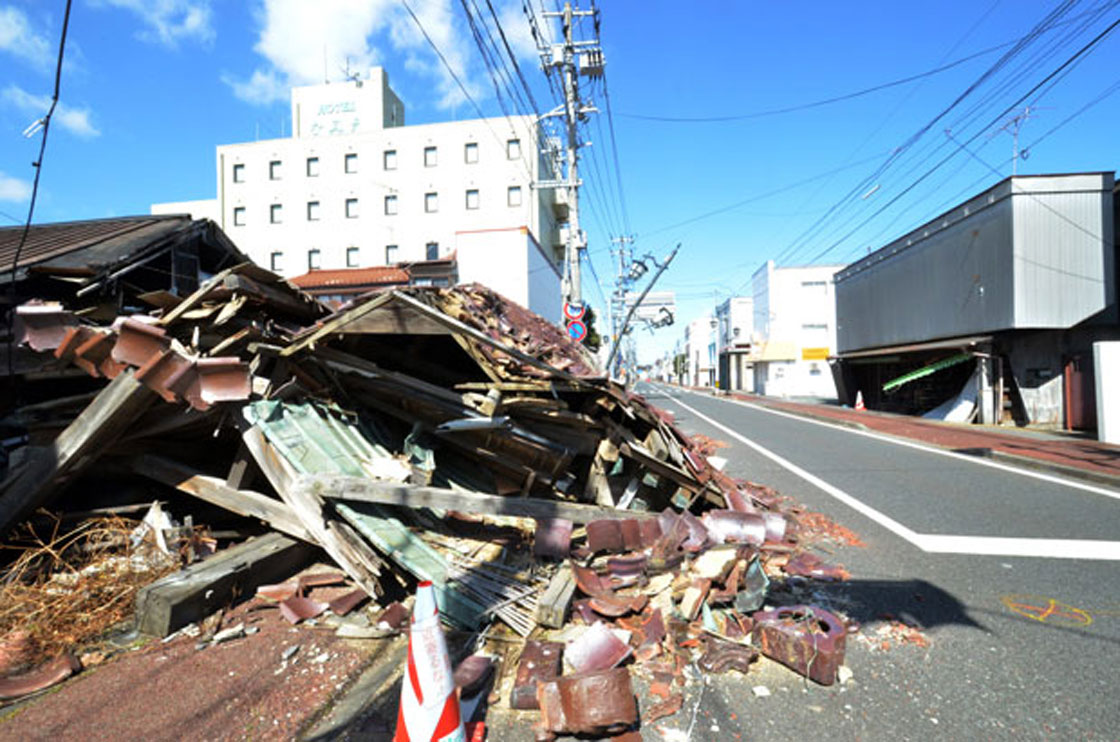
TORONTO – The streets of Namie-machi, Japan are desolate.

In the two years since the Fukushima nuclear disaster, the town has only been visited by those with government approval, donning hazmat suits and carrying radiation screening devices.
But thanks to Google, former residents and people around the world will be able to visit areas affected by the Fukushima nuclear disaster.
Google began collecting Street View imagery of the city of Namie-machi, located just north of the now disabled Dai-ichi nuclear plant, at the beginning of March at the request of the city. The 360-degree images will be published to Google’s ‘Memories for the Future’ website, once completed, in a few weeks.
“Our hope is that these materials will be shared with future generations to show what happened and to illustrate the enormous human impact of this disaster,” a Google spokesperson told Global News.
Google’s “Memories for the Future” website maps thousands of miles of areas affected by the earthquake and tsunami, as well as areas affected by the Fukushima nuclear disaster.
The website provides before and after images of areas including Ishinomaki, Onagawa and Soma and provides images of areas such as Rikuzentaka, Otsuchi and Kesennuma.
The Fukushima Dai-ichi nuclear power plant suffered a meltdown at three of its reactors as a result of the March 2011 earthquake and tsunami. Hydrogen explosions at another of the plant’s reactors, Unit 4, damaged a reactor building and a cooling pool, raising concerns in Japan and other countries, including the United States.
The meltdown caused radiation to be released into the surrounding air, soil and ocean and resulting in the displacement of 160,000 people from areas around the plant.
- Ont. First Nation calls for chemical plant to be shut down amid ‘dangerously high’ benzene levels
- Ottawa looks to launch national flood insurance program within 12 months
- Nova Scotia scraps spring bear hunt idea, public ‘very divided’ on issue
- Alberta, coal lobbyists talked for years about more open-pit mining in the Rockies: documents
Twenty thousand residents of Namie-machi have since relocated, unable to return to the area.
But mapping Namie-machi won’t be an easy task.
The area is still riddled with debris and worries of contaminated soil, water and buildings from radiation still remain a concern.

Google’s Street View team is following strict precautions to ensure the safety of those mapping the area.
“As part of the Street View imagery collection we have put in place strict safety precautions for the drivers that conform to the standards set by the Minister of Health, Labour, and Welfare as well as Fukushima Prefecture and Namie-machi,” said the Google spokesperson.
According to a report by The Telegraph, radiation levels within three of the reactor buildings at the Fukushima nuclear plant are still too high for people to start decommissioning the reactors.
Recent reports indicate that the decommissioning of the plant could take up to 40 years as its operator works on finding and removing nuclear fuel from inside, disposing the spent fuel rods and treating the tons of contaminated wastewater used to cool the reactors.
It is unclear what radiation levels measure in cities surround the plant, such as Namie-machi, but evacuees are still unsure if they will ever be able to return home because the radiation contaminated soil and water.
– With files from The Associated Press
Comments