
Thursday, January 18, 2018 – Weather forecast update at 5am:

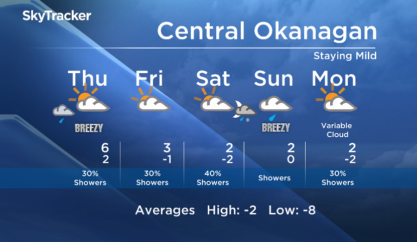
Circulation around an upper low that is stalling over the Central Coast of BC will keep partly cloudy conditions in the forecast as well as spotty showers.
Expect a few sunny breaks with a low to moderate chance of showers until Saturday.

Get daily National news
On Sunday, a new low forms over the same area on the coast and brings a stronger push of moisture inland with a greater precip chance on Sunday.
With freezing levels rising to near or over 1000m, daytime precipitation in the valley will stay as rain, but overnight precipitation may be a mix of rain and snow for valley bases.
- Most flood preparations complete in First Nation as it braces for rising water
- Residents of Peace River warned of possible flooding, to be ready to evacuate
- Spring snowstorm drops 10 cm of snow on Cranbrook, knocks out power
- Montreal community ramps up flood defences as rising river levels spark concern


Today’s daytime high range: 2 to 7C
We will have the rest of your weather details coming up at 5, 6:30 and 11pm – Hope you can join us!
~ Duane/Wesla
Comments
Want to discuss? Please read our Commenting Policy first.