

UPDATE: The snowfall warning mentioned in this story has ended

Snow slides out, -40 wind chills dive in.
Snowfall Warning
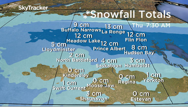
Environment Canada has issued a snowfall warning for Prince Albert, Melfort, Meadow Lake, La Ronge and other parts of north-central Saskatchewan for 10 to 15 centimetres of snow.
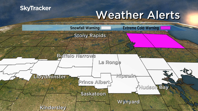
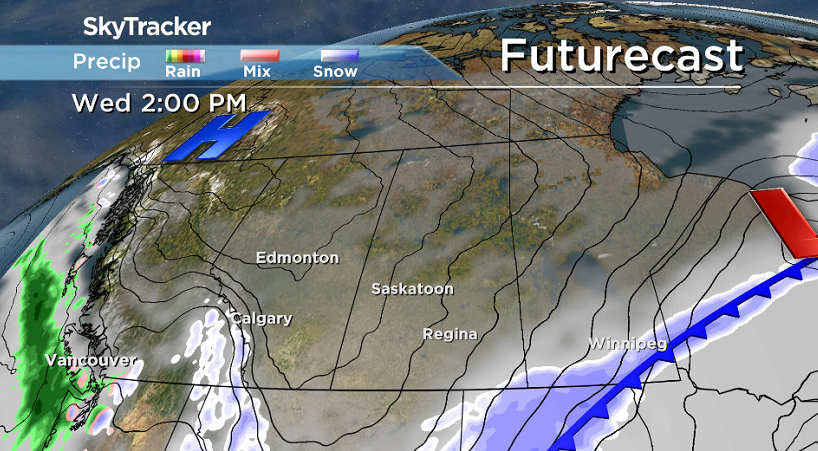
Heavy snow associated with a low pressure system in Alberta will spread across central Saskatchewan on Tuesday before ending Tuesday evening as the low moves into Manitoba.
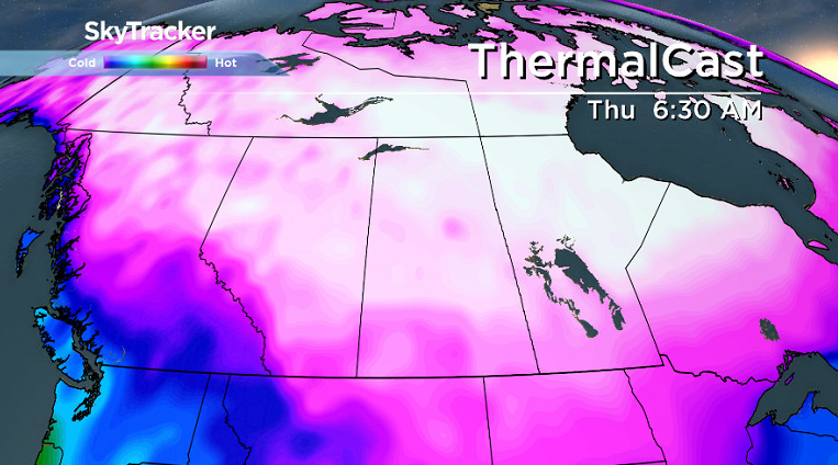
A cold northerly wind will develop in the wake of this weather system, ushering very cold temperatures back into the Prairies for the remainder of the week.
For the latest weather alerts download the Global News SkyTracker Weather App for iPhone, iPad or Android.
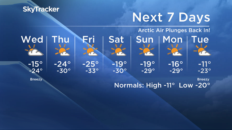
Saskatoon Forecast
Tuesday
Mostly cloudy skies acted like a blanket overnight and helped keep conditions mild to start the day with temperatures only dipping back to -8 by morning with wind chills in the mid-minus teens.
We warmed up to mid-minus single digits by midday in the clouds with snow falling further north right into the middle of the day.
Saskatoon tapped into some of that snow during the afternoon along with freezing rain and a few ice pellets as a low pressure system swung through with temperatures falling back into the -20s overnight as breezy northerly wind kicked us back into the cold.


Get daily National news
Wednesday
By morning, -30 is around what it’ll feel like with wind chill as you’re heading out the door as cloudy skies continue into the day.
Winds will be a bit breezy to start the day with gusts upwards of 30 to 40 km/h possible before easing back in the afternoon with temperatures hovering around -20 for the majority of the day before falling back into the mid -20s at night.


Thursday-Friday
An arctic high pressure system then drops in for the rest of the week keeping skies mostly sunny, but bringing back frigid conditions.
Daytime highs will tumble back into the mid -20s with overnight lows pushing into the -30s and extreme cold wind chill values in the -40s possible in the morning, which will only recover into the -30s during the day.
Weekend Outlook
Slightly warmer air is expected to slip in this weekend, which may allow daytime highs to potentially recover as warm as the minus teens, but overnight lows will still dip toward the -30s with partly to mostly sunny skies likely both days.
The Your Saskatchewan photo for Jan. 9 was taken near Saskatoon by Jim Gawluk:

READ MORE: Get a 2018 Your Saskatchewan Calendar today and support a great local charity
Saskatoon weather outlook is your source for Saskatoon’s most accurate forecast and is your one stop shop for all things weather for central and northern Saskatchewan with comprehensive, in depth analysis that you can only find here.
Comments
Want to discuss? Please read our Commenting Policy first.