
Wednesday, December 20, 2017 – Weather forecast update at 4pm:

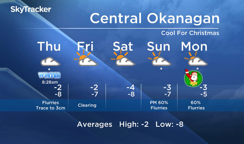
A chance of flurries will return Thursday, and although this next disturbance won’t pack as much punch as the last one, a trace to a few centimetres of snow is possible.

Get daily National news
Get daily Canada news delivered to your inbox so you'll never miss the day's top stories.
By providing your email address, you have read and agree to Global News' Terms and Conditions and Privacy Policy.
Signs point to a drier and cooler pattern Friday and Saturday.
For those of you wondering… the snow on the ground will stick around through the Christmas weekend as temperatures will stay near or below freezing.
- Strong atmospheric river forecast to hit coastal B.C. as spring break begins
- A blizzard, polar vortex, heat dome and atmospheric river: U.S. faces weather chaos
- Hurricane-strength winds knocked over semi trucks on the Coquihalla Highway
- Fraser Valley cleaning up after windstorm that knocked out power, closed schools


Thursday’s daytime high range: -4 to 0C
We will have the rest of your weather details coming up at 5, 6:30 and 11pm – Hope you can join us!
~ Duane/Wesla
Comments
Want to discuss? Please read our Commenting Policy first.