

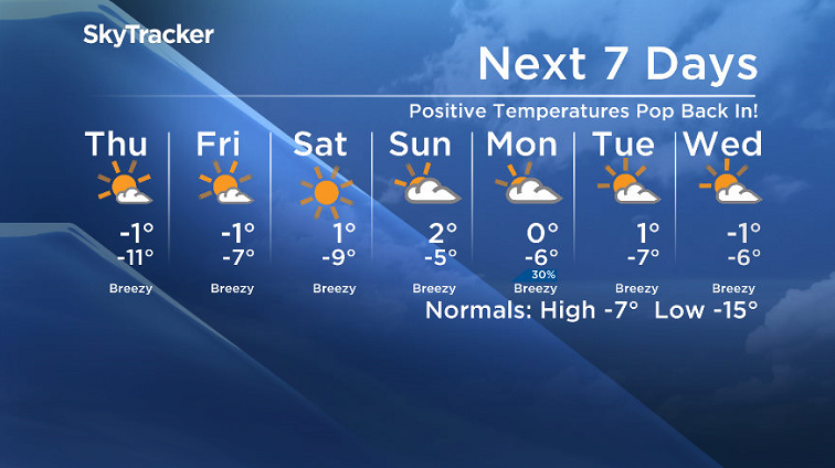
After -30 wind chills move back into Saskatoon, positive temperatures get ready to pop back in.

Saskatoon Forecast
Wednesday
-32 is what it felt like with wind chill in Saskatoon to start the day as temperatures tumbled back to a chilly -23 this morning after light snow eased and clouds cleared overnight.
We managed to make it back into the minus teens with some thick fog at times during the morning under mostly sunny skies and wind chills in the mid -20s.
Clouds rolled back in during the afternoon as warmer air pressed in from the west, which helped bump us up into minus single digits for a daytime high.

Get breaking National news
Thursday
-20 is around what it’ll feel like with wind chill Thursday morning with sunshine and a few clouds to start the day before skies clear and we get into more and more sun during the day.
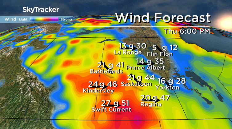
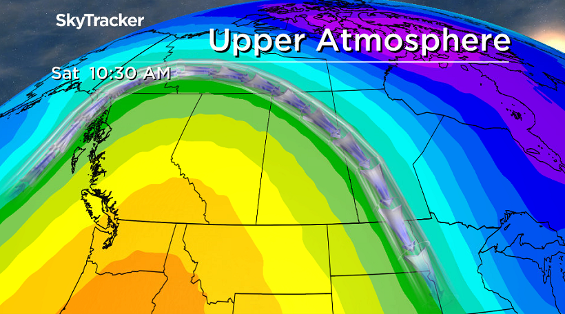
We can thank an upper ridge of high pressure building in for the sun and also for bringing in the warm air, with the mercury expected to soar up toward the freezing mark for an afternoon high, but breezy winds will make it feel like minus double digits still.
Friday
The upper ridge of heat continues to remain firmly planted just west of the region and as such, we’ll see more sunshine and warm air to round off the first full week of December.


It’ll be another warm day with temperatures climbing back up toward the freezing mark with breezy winds continuing at times.
Weekend Outlook
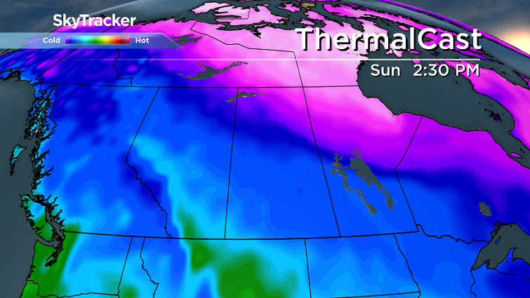
The heart of the heat in the core of the upper ridge pushes in on Saturday and may bump daytime highs up a degree or so above freezing both days with lots of sunshine on Saturday and more clouds moving in Sunday.
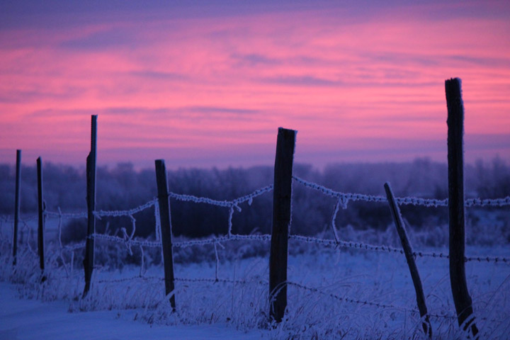
The Your Saskatchewan photo for Dec. 6 was taken by Stephanie Schneck near Asquith:
Saskatoon weather outlook is your source for Saskatoon’s most accurate forecast and is your one stop shop for all things weather for central and northern Saskatchewan with comprehensive, in depth analysis that you can only find here.
Comments
Want to discuss? Please read our Commenting Policy first.