

A big warm-up is on the way with positive temperatures possible ahead!

Saskatoon Forecast
Tuesday
Clouds and some light snow helped keep Saskatoon milder than we would’ve been had they cleared, with the mercury falling back to -17 with wind chills in the mid -20s to start the day.
Snow eased later in the morning, but clouds lingered as wind chills kept it feeling like the mid -20s into the afternoon.
Mostly cloudy skies stuck around for the afternoon as we bumped up a bit further into the minus teens.

Get daily National news
Wednesday
Minus 27 is around what it’ll feel like Wednesday morning with wind chill under cloudy skies with a slight chance of flurries to start the day and a risk of freezing rain south of the city.

Clouds are expected to clear out later in the day as we rise up to an afternoon high around -10 degrees.
Thursday-Friday
Warmer air spills in to end the week as an upper ridge builds in the heat and brings us into some more clouds on Thursday with temperatures potentially rising above freezing by evening as warm southwesterly winds kick in along with a low pressure system.


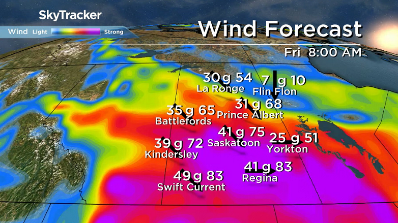
That system will then swing through on Friday and drop us into a cold northwesterly wind with gusts upwards of 60 to 70 km/h possible with a chance of rain changing to snow Thursday night into Friday morning as we cool back toward minus double digits by evening.
Weekend Outlook
Slightly cooler air will settle in behind the system on Saturday with lots of sunshine and a daytime high around -6 degrees before a slightly warmer Sunday with more clouds and an afternoon high a few degrees shy of the freezing mark.

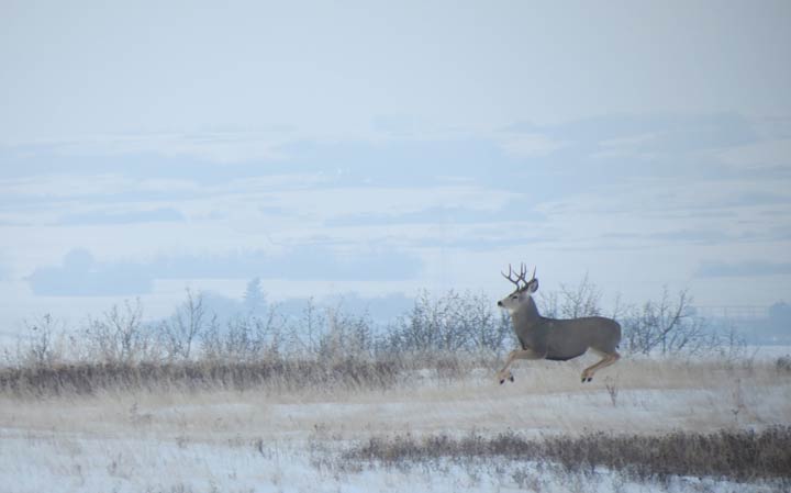
Ken Johnson took this Nov. 21 Your Saskatchewan photo near Vonda:
Saskatoon weather outlook is your source for Saskatoon’s most accurate forecast and is your one stop shop for all things weather for central and northern Saskatchewan with comprehensive, in-depth analysis that you can only find here.
Comments
Want to discuss? Please read our Commenting Policy first.