
UPDATE: All snowfall warnings mentioned in this story have ended

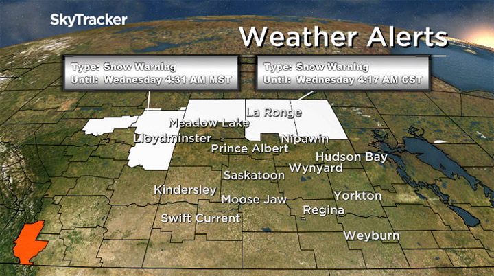
Parts of northern Saskatchewan are under a snowfall warning.
Environment Canada says a disturbance moving in from Alberta on Tuesday could bring between 10 and 15 centimetres of heavy snow.
Snow started falling Monday evening from Buffalo Narrows to Pelican Narrows.

Get breaking National news
The warning was expanded Tuesday morning to include Lloydminster and the Meadow Lake region. The snowfall warning has since ended for both those regions.
Blowing snow is expected to impact driving conditions and visibility could be suddenly reduced in the heavy snow.
Drivers should check the Saskatchewan highway hotline for the latest road conditions.


The snow is expected to taper off western regions later in the morning and early afternoon as the system pushes east.
Eastern regions can expected conditions to improve into Tuesday evening.
For the latest weather alerts download the Global News Skytracker weather app for iPhone, iPad or Android.
Snowfall warning for:
- Île à la Crosse – Buffalo Narrows – Beauval
- La Ronge – Prince Albert Nat. Park – Narrow Hills Prov. Park
- Pelican Narrows – Cumberland House – Creighton
Snowfall warning ended for:
- Lloydminster
- Meadow Lake – Big River – Green Lake – Pierceland


Comments