

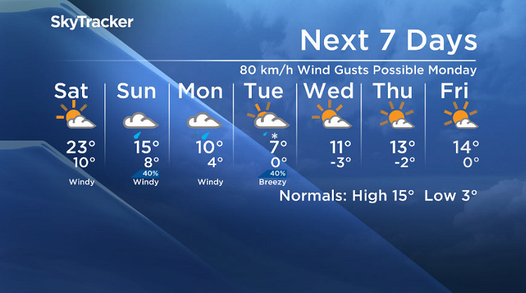
From a warm end to September to 80 km/h wind gusts, heavy rain and snow possible to kickoff October!

Saskatoon Forecast
Friday
A glorious end to September has been featured by pure blue skies and sunshine, all thanks to a big upper ridge of high pressure that moved in over Saskatchewan.
A mild 8 degrees was where Saskatoon started the day with sunny skies and a breezy south-southeasterly wind helping boost temperatures into the 20s by noon!
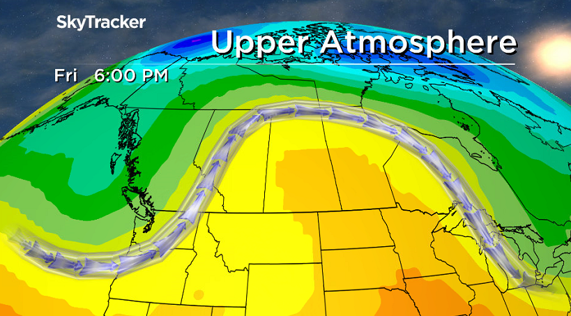
The climb continued into the afternoon with a daytime high into the mid 20s being reached under clear skies and sunshine.
Friday Night

Get daily National news
Clear skies continue into Friday night with the city sandwiched between systems, setting up a pressure gradient with strong southerly wind gusts upwards of 50 km/h, keeping warm air around as we dip back to 10 degrees.

Saturday
After a sunny start to the day, a system sliding into Saskatchewan will build in clouds later on and bring in a very slight chance of showers and risk of a thunderstorm into the evening.
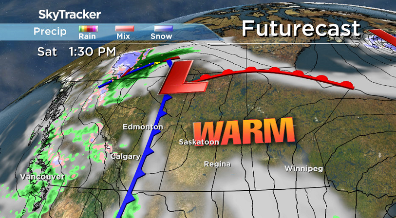
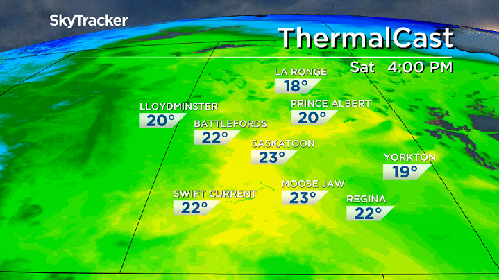
The upper ridge of heat will start moving out, but we’ll remain in the warm sector of the system during the day with a strong south-southeasterly wind continuing, which will help us rise back up to a high around 23 degrees or so.
Sunday
That system swoops right in over us on Sunday, keeping us in the clouds and bringing in a good chance of showers, especially later in the day, that will pick up to a steadier rain in the evening.

Depending if and when we get rain on Sunday, we could climb as high as the upper teens, but if some does slide in during the day, afternoon temperatures will likely top out in the mid teens instead.


Work Week Outlook
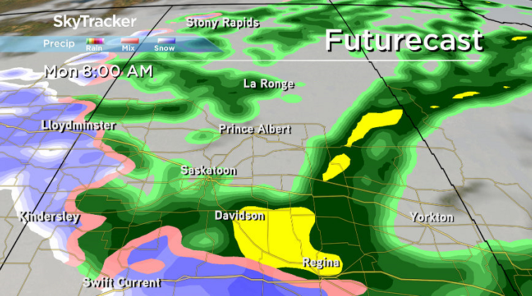
Heavy rain with that system and coupled trough swinging through will move in heading into Monday and linger during the day as cold air slides in and drops temperatures into single digits.
Near warning level strong winds will also accompany the day with sustained speeds up to 50 to 60 km/h and gusts in excess of 70 to 80 km/h possible.

That rain may switch over to snow in parts of western Saskatchewan during the evening with some wet flakes also possible in that region early Monday as well, depending how much cool air floods in.
The big question then will be, how long and where will the precipitation linger?
Most models are clearing it out a bit sooner with only western portions of Saskatchewan seeing a possibility of snow into Tuesday, but if precipitation lingers on Tuesday in Saskatoon, we may see some wet snow mix in for the city as well.

Some sunshine should kick in for the second half of the week, but it will take some time for temperatures to recover next week as a ridge tries to help rebuild daytime highs back into the mid teens.
Lisa Diewold took the Your Saskatchewan photo at Osage:

Saskatoon weather outlook is your source for Saskatoon’s most accurate forecast and is your one stop shop for all things weather for central and northern Saskatchewan with comprehensive, in depth analysis that you can only find here.
Comments
Want to discuss? Please read our Commenting Policy first.