

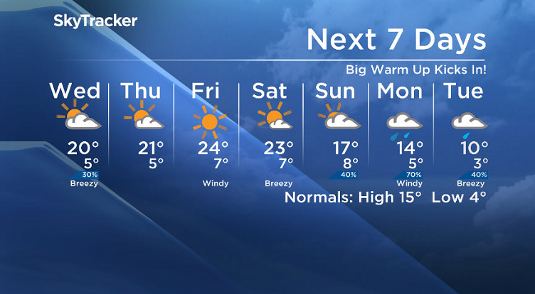
A big warm up kicks into the forecast ahead before a major change into next week!

Saskatoon Forecast
Tuesday
Mostly cloudy skies started the day as temperatures dipped back to 7 degrees during the morning.
Some scattered sprinkles slipped through the region with a more organized band of rain associated with a trough swinging through passing by midday.
The added moisture made it a bit harder to warm up, but we did eventually make it up into the low teens by midday and then up to 20 degrees later on with showers into the afternoon and a thunderstorm passing by south of North Battleford and east of Saskatoon.

Get daily National news
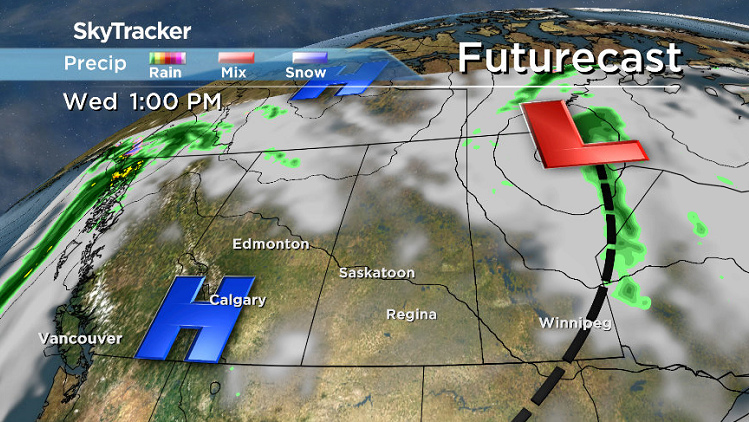
Wednesday
Another wave of clouds is expected to slide through and bring in partly to mostly cloudy skies during the day Wednesday with a very slight chance of showers in the afternoon.
Temperatures are expected to climb up into the mid-to-upper teens by noon before pushing up toward 20 degrees again for a daytime high.
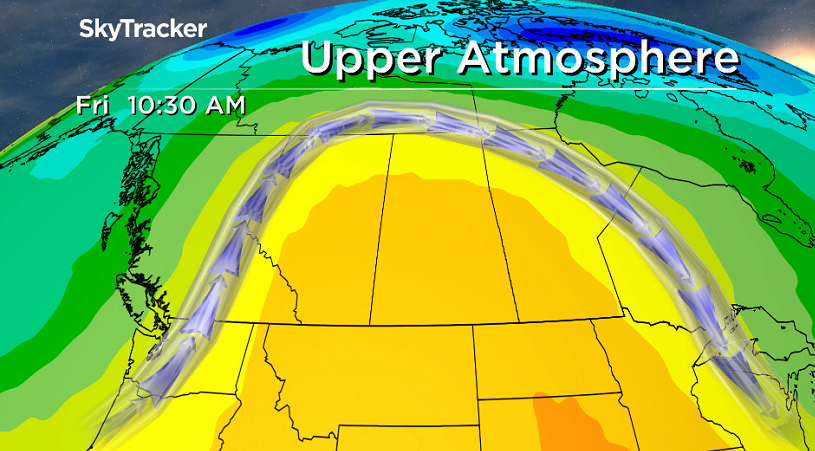
Thursday-Friday
The next push of heat kicks in for the end of the week under partly to mostly sunny skies on Thursday and then pure blue skies and sunshine on Friday.
The warm up is all thanks to an upper ridge of high pressure building in, which will push daytime highs from the low 20s Thursday into the mid 20s on Friday as we hit the peak of the heat.


Weekend Outlook
The ridge starts to break down on Saturday with a few more clouds likely and after reading a high in the mid 20s, a system will slide in and cool us down Sunday with more cloud and showers expected later on.
That system is expected to strengthen in southern Saskatchewan and is likely to bring heavy rain on Monday with some models mixing in the possibility of some wet snow into Tuesday.
We will keep an eye on the situation and should have a better idea as to the track of this system as the date approaches.
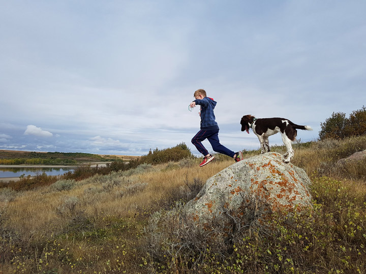
The Your Saskatchewan photo was taken in Outlook by Monica Jordan:
Saskatoon weather outlook is your source for Saskatoon’s most accurate forecast and is your one stop shop for all things weather for central and northern Saskatchewan with comprehensive, in depth analysis that you can only find here.


Comments